Archives - Page 3

  • Volume 28 cover page

    Review of Survey activities 2012
    Vol. 28 (2013)

    Edited by Ole Bennike, Adam A. Garde and W. Stuart Watt

    This Review of Survey activities presents a selection of 17 papers reflecting the wide spectrum of activities of the Geological Survey of Denmark and Greenland, from the microscopic to the plate-tectonic level.

    The Survey's activities in Denmark and surrounding areas are illustrated by nine articles covering Miocene geology, groundwater geology, marine geology, geological mapping, seismology, disposal of radioactive waste and the use of satellite radar data to detect elevation changes.

    Activities in Greenland are covered by seven papers dealing with mineral and petroleum exploration. One paper describes lineament mapping and another describes the Survey's monitoring of the Greenland ice sheet. The Survey's international activities are the subject of a paper dealing with titanium minerals in Cameroon. 

  • Volume 27 cover page

    Neoglacial and historical glacier changes around Kangersuneq fjord in southern West Greenland
    Vol. 27 (2012)

    Anker Weidick, Ole Bennike, Michele Citterio and Niels Nørgaard-Pedersen

    The Greenland ice sheet is losing mass at an accelerating rate due to climate change. Prediction of the future behaviour of the ice sheet depends on our understanding of the links between climatic variations and glacial fluctuations in the distant and recent past. This bulletin presents an overview of glacier fluctuations in south-western Greenland over the last 300 years, with particular focus on the inner parts of Nuup Kangerlua. The early record is based on written descriptions, paintings, photographs and maps of the area from the 1700s and 1800s, together with archaeological data from Norse ruins; aerial photographs and satellite images from the 1900s provide a link to the present.

    The lowland marine outlets from the Inland Ice in south-western Greenland were mainly characterised by large amplitude changes during the Late Holocene, as illustrated in this bulletin by the Kangiata Nunaata Sermia glacier system which has receded over 20 km during the last two centuries, demonstrating a marked response to climatic fluctuations during and since the Little Ice Age. Other examples of such behaviour are provided by the Eqalorutsit Killiit Sermiat glacier at the head of Nordre Sermilik fjord in southern Greenland, and by Jakobshavn Isbræ in Disko Bugt in central West Greenland. In contrast, where uplands and highlands extend below the marginal parts of the Inland Ice, the outlets have been advancing almost up to the present, so that the position of the glacier front around AD 2000 broadly coincides with the Little Ice Age maximum. It is notable, however, that the number of advancing outlets has decreased markedly in recent years.

  • Volume 26 cover page

    Review of Survey activities 2011
    Vol. 26 (2012)

    Edited by Ole Bennike, Adam A. Garde and W. Stuart Watt

    This Review of Survey activities presents a selection of 20 papers reflecting the wide spectrum of activities of the Geological Survey of Denmark and Greenland, from the microscopic to the plate-tectonic level.

    The Survey's activities in Denmark and surrounding areas are illustrated by 11 articles covering petroleum geology, groundwater geology, geomorphology, marine geology, geothermal energy, seismology and monitoring of an underground gas storage.

    Activities in Greenland are covered by five papers dealing with mineral and petroleum exploration. Two other papers describe the Survey's monitoring of the Greenland ice sheet and the testing of an automatic earthquake detection method on data from Station Nord, North Greenland.

    The Survey's international activities are the subject of two papers: one dealing with petroleum geology in Vietnam, one with agrominerals in Tanzania.

  • Volume 25 cover page

    Upper Cretaceous chalk facies and depositional history recorded in the Mona-1 core, Mona Ridge, Danish North Sea
    Vol. 25 (2011)

    ​Kresten Anderskouv and Finn Surlyk

    Upper Cretaceous – Danian chalks form important hydrocarbon reservoirs in the North Sea, contributing significantly to the national economies of Denmark, Norway and the United Kingdom. Understanding the process of chalk sedimentation thus has implications not only for charting the evolution of the Cretaceous chalk sea, but also for predicting the distribution and nature of potential reservoir chalks in the subsurface. In particular, North Sea chalk reservoirs commonly include a range of redeposited chalk facies types, yet rigorous documentation of such facies is scarce in the published literature.

    This bulletin presents a detailed analysis of chalk deposits from an exceptionally well-cored borehole (Mona-1) in the northern Danish Central Graben. Chalk sedimentation in this area in the Late Cretaceous was strongly influenced by active intrabasinal tectonics, controlling sea-floor morphology and the location of depocentres. Chalk ooze was commonly remobilised, creating a wide spectrum of chalk facies types that record processes ranging from suspension settling to slumping and debris flow.

  • Volume 24 cover page

    The East Greenland rifted volcanic margin
    Vol. 24 (2011)

    C. Kent Brooks

    The East Greenland sector of the Palaeogene–Recent North Atlantic Igneous Province is one of the Earth's largest and best exposed igneous manifestations, and it includes the Skaergaard intrusion, probably the most studied igneous body worldwide. This volume contains an introductory historical review, descriptions of the igneous activity and related mineralisation processes in the regions throughout its rifting, spreading, stabilisation and uplift history. Finally, the underlying, plate-tectonic mantle processes are discussed. The text is accompanied by an extensive reference list and an appendix with selected age data from several sources.

    The author, C. Kent Brooks, has an intimate knowledge of the entire region from numerous expeditions and research projects in close collaboration with Danish and international scientists and research students, including three major expeditions of the Danish Lithosphere Centre in 1994–2000.


  • Volume 23 cover page

    Review of Survey activities 2010
    Vol. 23 (2011)

    Edited by Ole Bennike, Adam A. Garde and W. Stuart Watt

    This Review of Survey activities presents a selection of 19 papers reflecting the wide spectrum of activities of the Geological Survey of Denmark and Greenland, from the microscopic to the plate-tectonic level.

    The Survey's activities in Denmark and surrounding areas are illustrated by 12 articles covering petroleum geology, groundwater geology, applied marine geology, Quaternary stratigraphy, sea-level changes, disposal of radioactive waste and the use of satellite radar data to detect elevation changes. The depth of two earthquakes has been determined using data from array stations in Canada and Niger.

    Activities in Greenland are covered by six papers dealing with mineral and petroleum exploration. One paper comes with further evidence that the controversial Wegener Fault is a myth. The influence of recent climate change on the Greenland ice sheet is the subject of another article; 2010 was the warmest year ever recorded in Greenland, and the ice sheet is losing mass at an accelerating rate.

    The Survey's international activities are the subject of a paper dealing with quality control of geophysical data in Ghana.

  • Volume 22 cover page

    Lithostratigraphy of the Upper Oligocene – Miocene succession of Denmark
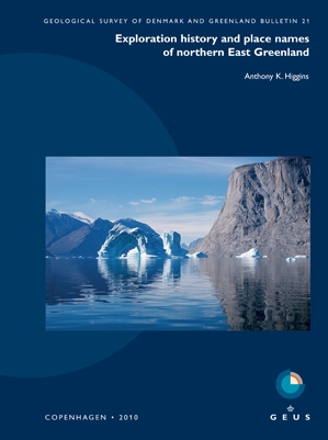
    Vol. 22 (2010)

    Erik Skovbjerg Rasmussen, Karen Dybkjær and Stefan Piasecki

    The Upper Oligocene – Miocene succession of onshore Denmark is about 250 m thick and is composed of interdigitating, coarse-grained fluvio-deltaic and mud-rich marine sediments; it is best exposed in coastal cliffs in eastern and northern Jylland but is also seen locally inland. These sediments contain important natural resources such as brown coals, clays, and sand and gravel deposits (locally rich in heavy minerals), and thus have been the focus of study since the 19th century. In recent years, the growing demand for a reliable source of drinking water has led to renewed interest in the succession. The resultant intensive drilling campaign – over 100 boreholes now penetrate the succession – and high-resolution seismic surveys have made it possible to reconstruct in detail the subsurface architecture of the sedimentary basin and to chart the evolution of the landscape between 25 and 8 million years ago.

    This bulletin presents a revised lithostratigraphy of the Upper Oligocene – Miocene succession of onshore western Denmark. The Upper Oligocene is referred to the Brejning Formation, which is subdivided into two members, one of which is new. The Miocene is subdivided into two new groups: the Ribe and Måde Groups. The former (Lower–Middle Miocene) comprises six formations (two new, four revised) and eight members, six of which are erected here. The Måde Group (Middle–Upper Miocene) consists of four formations, of which two are new lithostratigraphic units.

  • Volume 21 cover page

    Exploration history and place names of northern East Greenland
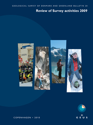
    Vol. 21 (2010)

    Anthony K. Higgins

    This Bulletin records the exploration history of northern East Greenland in three phases: the pioneer exploration and discovery from c. 2400 BC to 1912; commercial activities, early mountaineering and geological mapping from 1919 to 1960; and modern scientific investigations, adventure and sporting expeditions from 1961 to 2008. The catalogue of place names that forms the bulk of this volume gives the location and origin of more than 5650 approved and unapproved names.

    The early exploration of northern East Greenland was carried out by many different nations, whose objectives varied from seeking a route to the North Pole, searching for missing polar explorers, commercial whaling and sealing to primary exploration and mapping. After the Norwegian–Danish dispute over the sovereignty of parts of East Greenland was settled at the International Court of Justice in The Hague in 1933, the Place Name Committee for Greenland (Stednavneudvalget) was established, and the place names used on existing published maps of Greenland were systematically reviewed and with few exceptions approved in danicised form.

    More than 3000 place names were officially approved by the Place Name Committee for use in northern East Greenland up to the end of 1984, after which responsibility passed to the Home-Rule government at Nuuk in Green- land. More than a third of these place names were proposed by members of the expeditions led by the Danish geologist Lauge Koch. The post-war expeditions led by Lauge Koch were almost entirely geological in nature, and the place names given reflect in part geological characteristics of the features named, the animals encountered and events during the expeditions, as well as commemorating the mountains, lakes and other features of the home countries of the participants. 

  • Volume 20 cover page

    Review of Survey activities 2009
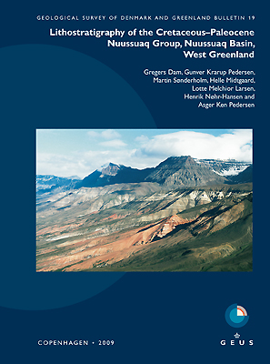
    Vol. 20 (2010)

    Edited by Ole Bennike, Adam A. Garde and W. Stuart Watt

    This Review of Survey activities presents a selection of 23 papers reflecting the wide spectrum of activities of the Geological Survey of Denmark and Greenland, from the microscopic to the plate-tectonic level. In addition, an obituary about the former director of the Geological Survey of Greenland (GGU), Knud Ellitsgaard-Rasmussen, is included together with a short overview of the history of GGU.

    The Survey's activities in the Danish region are illustrated by six articles covering petroleum exploration, geothermal reservoirs in Denmark, a Miocene wave-dominated delta, radon problems and recent man-made nutrient changes in a lake. Three other articles from this geographical area describe applied marine geology, Quaternary stratigraphy and methods of mapping deep groundwater reservoirs.

    Activities in Greenland and the Faroe Islands are covered by nine papers dealing with mineral and petroleum exploration and climate history, the influence of recent climate change on the Greenland ice sheet and current investigations related to extended continental shelf claims offshore Greenland and the Faroe Islands.

    The Survey's international activities are the subject of four papers, dealing with Tanzania, Vietnam and China.

    The last article describes a new method to analyse and present scanning electron microscopy data. 


  • Volume 19 cover page

    Lithostratigraphy of the Cretaceous–Paleocene Nuussuaq Group, Nuussuaq Basin, West Greenland
    Vol. 19 (2009)

    Gregers Dam, Gunver Krarup Pedersen, Martin Sønderholm, Helle H. Midtgaard, Lotte Melchior Larsen, Henrik Nøhr-Hansen and Asger Ken Pedersen

    The Nuussuaq Basin contains several kilometres of siliciclastic sediments overlain by a thick pile of volcanic rocks. The sediments, which are exposed on Disko, Nuussuaq, Upernivik Ø, Qeqertarsuaq and Svartenhuk Halvø in central West Greenland, have been studied since the early 19th Century. The focus has changed through time from early studies on the occurrence of coal, fossil plants and invertebrate fossils to modern sedimentological and stratigraphical studies to decipher basin evolution and to encourage exploration for hydrocarbons.

    The Nuussuaq Basin is the only onshore analogue for the subsurface sedimentary basins offshore West Greenland that are known primarily from seismic data. It is consequently important that the Nuussuaq Basin outcrops are at a scale comparable to seismic sections and furthermore that the lithostratigraphic subdivision presented here emphasises unconformity-bounded formations that potentially may be traced regionally, also on offshore seismic data.

    This bulletin presents the lithostratigraphy of the Cretaceous–Paleocene sedimentary succession of the Nuussuaq Basin. The Nuussuaq Group (new) overlies Precambrian basement rocks and is overlain by volcanic rocks of the West Greenland Basalt Group. The Nuussuaq Group comprises ten formations, five of which are erected herein whilst the remainder are redefined or revised in accordance with modern practice. Six of these formations are further divided into members (a total of eighteen, of which fifteen are new) and two beds are formally erected.


  • Volume 18 cover page

    Greenland from Archaean to Quaternary. Descriptive text to the 1995 Geological map of Greenland, 1:2 500 000. 2nd edition
    Vol. 18 (2009)

    Niels Henriksen, A.K. Higgins, Feiko Kalsbeek and T. Christopher R. Pulvertaft

    Greenland's geological development spans a period of c. 4 Ga from the Eoarchaean to the Quaternary. An overview of the geology was presented in 1995 on a geological map at a scale of 1:2 500 000, followed by a descriptive text to the map printed in 2000 as Geology of Greenland Survey Bulletin 185.

    Since the first edition of this work was published, large amounts of new data have been acquired, notably in the offshore regions, in relation to mineral prospecting and in connection with regional geological mapping projects. This 2nd edition aims at providing an updated overview of the geology of Greenland with reference to the enclosed geological map sheet from 1995 that in general terms is still valid.

    This bulletin (Geological Survey of Denmark and Greenland Bulletin 18) comprises descriptions of the Greenland Precambrian shield with its Archaean to Proterozoic crystalline complexes, the bordering Proterozoic and Palaeozoic sedimentary basins, Palaeozoic fold belts, late Palaeozoic–Mesozoic sedimentary basins, Palaeogene (lower Tertiary) volcanic rocks, and Quaternary deposits. Special chapters treat offshore geology, mineral deposits and petroleum potential.

    The volume includes an extensive subject index, a place names register, a special legend explanation and an updated and expanded reference list that enables the reader to follow up on new data and details in agreement with modern interpretations.


  • Volume 17 cover page

    Review of Survey activities 2008
    Vol. 17 (2009)

    Edited by Ole Bennike, Adam A. Garde and W. Stuart Watt

    This Review of Survey activities presents a selection of 19 papers reflecting the wide spectrum of activities of the Geological Survey of Denmark and Greenland, including field-based, laboratory and remote sensing studies.

    The Survey's activities in Denmark are illustrated by ten articles covering the following topics: a marked earthquake, the potential for geological storage of CO2, oil geology, fingerprinting of sand, Quaternary geology and groundwater.

    Activities in Greenland are dealt with in eight papers on mineral and petroleum exploration, the bedrock geology below the Greenland ice sheet, applied glaciology and climate development.

    The survey also carries out many projects outside Denmark and Greenland. This bulletin includes a description of a multinational project on landscape development in Brazil.

  • Volume 16 cover page

    Evaluation of the quality, thermal maturity and distribution of potential source rocks in the Danish part of the Norwegian-Danish Basin
    Vol. 16 (2008)

    Henrik I. Petersen, Lars H. Nielsen, Jørgen A. Bojesen-Koefoed, Anders Mathiesen, Lars Kristensen and Finn Dalhoff *

    The results of hydrocarbon exploration in the Norwegian–Danish Basin in northern Denmark over the past 70 years have been largely disappointing. Although the principal components of a viable petroleum system are in place, the existence of effective source rocks has been questioned.

    This bulletin presents an evaluation of the quality, extent and thermal maturity of potential source rocks within the Palaeozoic–Mesozoic succession of the Danish part of the Norwegian–Danish Basin. A range of potential source rocks are documented, of which those in the Jurassic – lowermost Cretaceous are judged the most promising. Over much of the basin, these Mesozoic source rocks have experienced insufficient burial to have produced hydrocarbons – the source rocks are regionally immature or only marginally mature. Local hydrocarbon kitchens with mature source rocks may be present in the centre of the basin, however, associated with salt structures and minor grabens.


  • Volume 15 cover page

    Review of Survey activities 2007
    Vol. 15 (2008)

    Edited by Ole Bennike and A.K. Higgins

    This Review of Survey activities presents a selection of 22 papers reflecting the wide spectrum of activities of the Geological Survey of Denmark and Greenland, from the microscopic to the plate-tectonic level.

    The Survey's activities in Denmark are illustrated by 13 articles. Five of them deal with petroleum-related topics and two others with groundwater-related topics. Four others describe raw material activities and environmental change, one paper presents a new Base Quaternary map of Denmark and one paper describes the deep structure below Denmark.

    Activities in Greenland are covered by five papers. Three of these address mineral and petroleum exploration, one concerns monitoring of the Greenland ice sheet and one focuses on historic investigations of Hans Ø, a small island in Nares Strait between Greenland and Canada.

    International projects and two new geoscientific methods: The survey also carries out many projects outside Denmark, Greenland and the Faroe Islands. This bulletin includes descriptions of a coastal protection project in Kenya and a multinational project dealing with the implementation of the European Union's Water Framework Directive. Finally, two examples of new developments in instrumental geoscience are presented.


  • Volume 14 cover page

    Quaternary glaciation history and glaciology of Jakobshavn Isbræ and the Disko Bugt region, West Greenland: a review
    Vol. 14 (2007)

    Anker Weidick and Ole Bennike

    "Der Jakobshavner Eisstrom ist der König unter
    Den grönlandischen Gletschern. Kein anderer der
    Schnellaufenden Inlandeis-Abflüsse füllt so wie er
    Seinen Fjord mit Eisberge an."
    (Alfred Wegener 1930)

    Central West Greenland is characterised by a number of permanent ice streams, a term introduced by H.J. Rink, who conducted the first glaciological investigations in Greenland. Jakobshavn Isbræ is one of the fastest and most important ice streams draining the Greenland ice sheet. In recent years, the velocity of Jakobshavn Isbræ has increased, and since 2002 a marked recession of the ice front has taken place.

    This bulletin provides a review of the Quaternary development of the Disko Bugt region, but we also present new radiocarbon age determinations that provide constraints on the Holocene development of the Jakobshavn Isbræ. Disko Bugt was deglaciated rapidly in the early Holocene, around 10 500–10 000 years ago. The margin of the Inland Ice attained a position close to that seen today 8000–6000 years ago, and about 5000 years ago, it was located east of its present position. The subsequent Neoglacial readvance culminated around A.D. 1850, during the Little Ice Age.

31-45 of 58