Greenland from Archaean to Quaternary. Descriptive text to the 1995 Geological map of Greenland, 1:2 500 000. 2nd edition
Niels Henriksen, A.K. Higgins, Feiko Kalsbeek and T. Christopher R. Pulvertaft
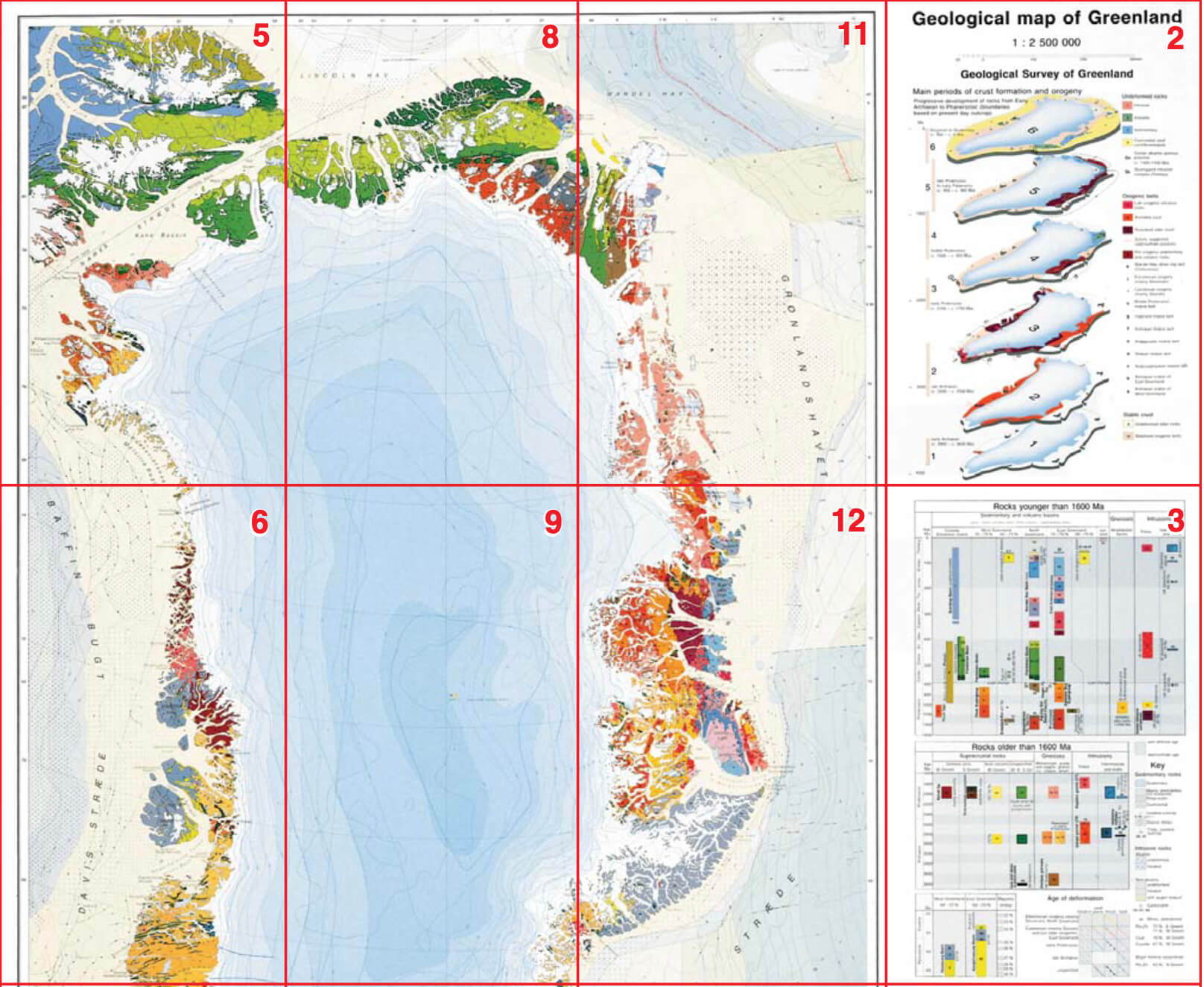
Greenland's geological development spans a period of c. 4 Ga from the Eoarchaean to the Quaternary. An overview of the geology was presented in 1995 on a geological map at a scale of 1:2 500 000, followed by a descriptive text to the map printed in 2000 as Geology of Greenland Survey Bulletin 185.
Since the first edition of this work was published, large amounts of new data have been acquired, notably in the offshore regions, in relation to mineral prospecting and in connection with regional geological mapping projects. This 2nd edition aims at providing an updated overview of the geology of Greenland with reference to the enclosed geological map sheet from 1995 that in general terms is still valid.
This bulletin (Geological Survey of Denmark and Greenland Bulletin 18) comprises descriptions of the Greenland Precambrian shield with its Archaean to Proterozoic crystalline complexes, the bordering Proterozoic and Palaeozoic sedimentary basins, Palaeozoic fold belts, late Palaeozoic–Mesozoic sedimentary basins, Palaeogene (lower Tertiary) volcanic rocks, and Quaternary deposits. Special chapters treat offshore geology, mineral deposits and petroleum potential.
The volume includes an extensive subject index, a place names register, a special legend explanation and an updated and expanded reference list that enables the reader to follow up on new data and details in agreement with modern interpretations.