How to Cite
Share
Abstract
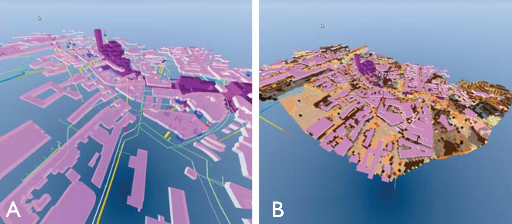
The subsurface material in urban areas comprises the original geological succession together with anthropogenic modifications and deposits. The Geological Survey of Denmark previously performed geological mapping in selected Danish cities (e.g. Mertz 1974), but this practice stopped in the mid-1980s. The lack of recent systematic mapping in urban areas is apparent not only in Denmark but also in most other European countries (COST 2015). However, there is a growing demand for knowledge of the subsurface beneath our cities for a number of reasons: increased urbanisation, infiltration of excess surface water and other climate-change related measures, thermal storage, groundwater cooling and abstraction, subsurface infrastructure, infrastructure projects, etc. The physical properties of the subsurface material are in constant change due to urban growth and infrastructure development. This can strongly influence the geotechnical properties and handling of excess surface water. In order to manage both challenges and opportunities of the ground beneath the cities there is a growing need for 3D hydrogeological models that can encompass all relevant parts of the physical subsurface system and act as operational tools in its management. With the main focus on hydrogeology and the urban water cycle, the Municipality of Odense, the local waterworks (VandCenter Syd), the Geological Survey of Denmark and Greenland (GEUS) and two consultants (Alectia and I-GIS) have made a joint effort to systematically map the subsurface layers and build a 3D hydrogeological model of the subsurface of the city of Odense (Fig. 1). This paper provides an overview of the project rationale and an outline of the major results.
How to Cite
Share
Downloads
Editors Adam A. Garde, Ole Bennike, Kristine Thrane and W. Stuart Watt
This issue of Review of Survey Activities presents a selection of 24 papers reflecting the wide spectrum of current activities of the Geological Survey of Denmark and Greenland, from the microscopic to the plate-tectonic level.
The Survey’s activities in Denmark are illustrated [...]


