How to Cite


Share

This work is licensed under a Creative Commons Attribution 4.0 International License.
Abstract
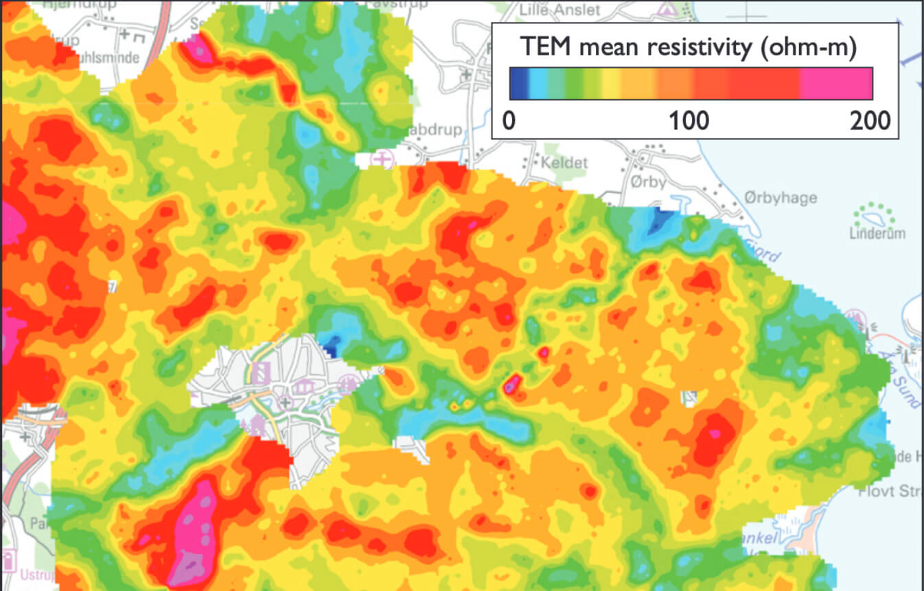
Buried valleys are elongate erosional structures in the Danish subsurface now partly or completely filled and covered with younger sediments. The majority was formed by meltwater underneath ice sheets. The number of buried-valley structures in Denmark is large, and because the valley-infill in many areas hosts significant groundwater resources, knowledge of them and their formation is important. This was the starting point of the buried-valley mapping project, which was initiated in the late 1990s and continued until the end of 2015 (Sandersen & Jørgensen 2016). This project became part of the National Groundwater Mapping Programme which was set up with the purpose of mapping the groundwater resources within areas of specific groundwater interest (Thomsen et al. 2004). The areas of specific groundwater interest encompass existing catchment areas and cover around 40% of the country. Within these areas, high-density electromagnetic surveys have typically been performed together with exploration drilling and supplementary geophysical measurements. The mapping of the buried valleys has been based on these newly collected data as well as existing data in the national databases. In some instances, it has also been possible to map buried valleys in less data-dense areas outside the surveyed areas, mainly on the basis of borehole data.
How to Cite
Share
Downloads
Editors Adam A. Garde and Ole Bennike
The 17 contributions in this Review of Survey activities reflect the wide range of activities currently performed by the Geological Survey of Denmark and Greenland, commonly in collaboration with external partners.
Topics in and around Denmark include the important Danish potential for geothermal energy, a shale gas [...]