How to Cite


Share
Copyright (c) 2010 Flemming Jørgensen, Rasmus Rønde Møller, Peter B.E. Sandersen, Lars Nebel

This work is licensed under a Creative Commons Attribution 4.0 International License.
Abstract
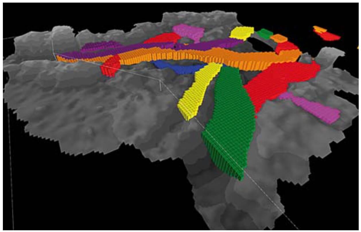
Contamination of groundwater with pesticides and nitrate has compelled the Danish Government to launch a major hydrogeological mapping programme covering about 40% of the land area of Denmark. Numerous geophysical surveys are currently being carried out in order to acquire the necessary data. These new data are crucial for the 3-D geological models that are used in the planning of future water supply and landuse. Normally, site-specific groundwater protection zones (Thomsen et al. 2004) are based on groundwater modelled catchment areas for each well, but proper 3-D geological models are needed in order to create a valid basis for the groundwater models. Since most of the Danish nearsurface geology is complex, a full geological understanding is required combined with in-depth interpretation of geological and geophysical data. Much research has dealt with geophysical mapping and numerical groundwater modelling, but only limited research has combined these topics for geological modelling. Prior to geophysical mapping, groundwater models were based on simple data extraction from well databases without inclusion of geophysical data. In the following, a concept for detailed 3-D geological modelling with hydrogeophysical data is presented for a specific area.
How to Cite
Share
Copyright (c) 2010 Flemming Jørgensen, Rasmus Rønde Møller, Peter B.E. Sandersen, Lars Nebel
This work is licensed under a Creative Commons Attribution 4.0 International License.
Downloads
Edited by Ole Bennike, Adam A. Garde and W. Stuart Watt
This Review of Survey activities presents a selection of 23 papers reflecting the wide spectrum of activities of the Geological Survey of Denmark and Greenland, from the microscopic to the plate-tectonic level. In addition, an obituary about the former director of the [...]