How to Cite


Share
Copyright (c) 2007 Peter Voss, Stine Kildegaard Poulsen, Sebastian Bjerregaard Simonsen, Søren Gregersen

This work is licensed under a Creative Commons Attribution 4.0 International License.
Abstract
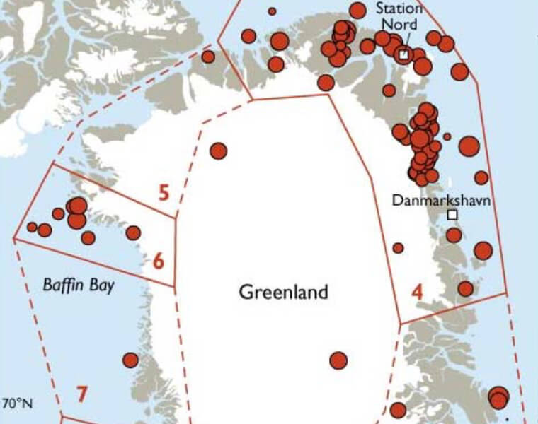
Earthquake activity in Greenland has been registered and mapped since 1907 (Larsen et al. 2006) and thus a long (albeit relatively sparse) record of seismic activity is available for evaluation of seismic hazard and risk. Seismic hazard assessment is carried out by judging the probability of future earthquakes in a given region and is based on statistic treatment of earthquake data. The determination of the seismic hazard is the first step in an evaluation of seismic risk, i.e. the possible economic costs and loss of human life after an earthquake. The motivation for this seismic hazard study is the registration of four significant earthquakes in Greenland in 2005. The Geological Survey of Denmark and Greenland (GEUS) received reports of all four earthquakes from residents who had felt the shaking. The 2005 earthquakes were located at or near Qeqertarsuaq on 30 March, Sisimiut on 23 July, Station Nord on 30 August and Attu on 23 October (Fig. 1), with magnitudes on the Richter scale of 4.3, 4.1, 5.1 and 2.5, respectively. The earthquake in Attu led to the inhabitants fleeing in their boats.
How to Cite
Share
Copyright (c) 2007 Peter Voss, Stine Kildegaard Poulsen, Sebastian Bjerregaard Simonsen, Søren Gregersen
This work is licensed under a Creative Commons Attribution 4.0 International License.
Downloads
Edited by Martin Sønderholm and A.K. Higgins
The Review of Survey activities presents a selection of 17 papers reflecting the wide spectrum of activities of the Geological Survey of Denmark and Greenland, from the microscopic to the plate-tectonic level.
Activities in Denmark: The Survey's field of activities in Denmark is illustrated by three papers on [...]