How to Cite


Share
Copyright (c) 2007 Johan M Bonow, Peter Japsen, Paul F Green, Robert W Wilson, James A Chalmers, Knud Erik S Klint, Jeroen A M van Gool, Karna Lidmar-Bergström, Asger Ken Pedersen

This work is licensed under a Creative Commons Attribution 4.0 International License.
Abstract
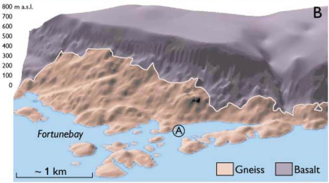
The western margin of the Greenland craton has been much less stable in the Phanerozoic than previously thought. This new insight has come from close integration of independent datasets: geomorphological analysis of large-scale landscapes, apatite fission track analysis (AFTA), onshore and offshore stratigraphy and analysis of onshore fault and fracture systems. Each data set records specific and unique parts of the event chronology and is equally important to establish a consistent model. A key area for understanding the Mesozoic– Cenozoic landscape evolution and into the present is the uplifted part of the Nuussuaq Basin, where remnants of planation surfaces cut across the Cretaceous to Eocene sedimentary and volcanic rocks. Our integrated analysis concluded that the West Greenland mountains were formed by late Neogene tectonic uplift (Fig. 1) and also provided new insight into early Phanerozoic development. To understand our model, we present the different methods and the results that can be deduced from them.
How to Cite
Share
Copyright (c) 2007 Johan M Bonow, Peter Japsen, Paul F Green, Robert W Wilson, James A Chalmers, Knud Erik S Klint, Jeroen A M van Gool, Karna Lidmar-Bergström, Asger Ken Pedersen
This work is licensed under a Creative Commons Attribution 4.0 International License.
Downloads
Edited by Martin Sønderholm and A.K. Higgins
The Review of Survey activities presents a selection of 17 papers reflecting the wide spectrum of activities of the Geological Survey of Denmark and Greenland, from the microscopic to the plate-tectonic level.
Activities in Denmark: The Survey's field of activities in Denmark is illustrated by three papers on [...]