How to Cite
Share
Abstract
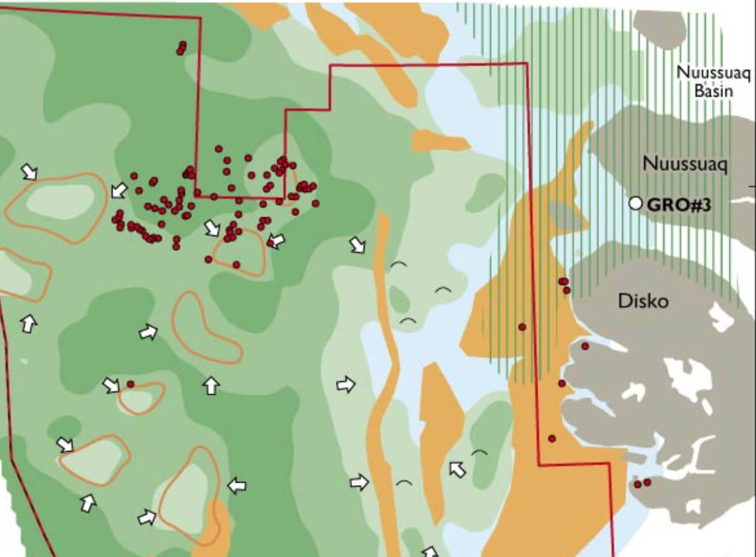
A detailed geophysical mapping project has been carried out by the Geological Survey of Denmark and Greenland (GEUS) in the offshore region south-west and west of Disko and Nuussuaq, central West Greenland as part of the preparations for the Disko West Licensing Round in 2006 (Fig. 1). The main purpose of the study was to evaluate the prospectivity of this almost 100 000 km2 large region, and to increase knowledge of basin evolution and the structural development. Results of the work, including a new structural elements map of the region and highlights of particular interest for hydrocarbon exploration of this area, are summarised below. Evidence of live petroleum systems has been recognised in the onshore areas since the beginning of the 1990s when seeps of five different oil types were demonstrated (Bojesen-Koefoed et al. 1999). Oil seeps suggesting widely distributed marine source rocks of Mesozoic age are particularly promising for the exploration potential (Bojesen-Koefoed et al. 2004, 2007). Furthermore, possible DHIs (Direct Hydro carbon Indicators) such as gas-clouds, pock marks, bright spots and flat events have been interpreted in the offshore region (Skaarup et al. 2000; Gregersen & Bidstrup in press). The evaluation of the region (Fig. 1) is based on all public and proprietary seismic data together with public domainmagnetic and gravity data. The seismic data (a total of c. 28 000 line km) are tied to the two existing offshore exploration wells in the region (Hellefisk-1 and Ikermiut-1). The study also incorporates information on sediments and volcanic rocks from onshore Disko and Nuussuaq (Fig. 2). Ten seismic horizons ranging from ‘mid-Cretaceous’ to ‘Base Quaternary’ (Fig. 2) have been interpreted regionally. Large correlation distances to wells, varying data quality and a thick cover of basalt in the north-eastern part of the region, add uncertainty in the regional interpretation, especially for the deeper horizons such as the ‘mid-Cretaceous’ equivalent to Santonian sandstone interval drilled in Qulleq-1 far south. Based on the seismic interpretation (Fig. 3) structural elements maps, horizon-depth maps and isopach maps have been produced; these maps, together with general stratigraphic knowledge on potential reservoirs, seals and source rocks (Fig. 2), provide important information for discussions of critical play elements including kitchens and structures.
The existence of many large structures combined with the evidence of live petroleum systems has spurred the recent major interest for hydrocarbon exploration in the region.
How to Cite
Share
Copyright (c) 2007 Ulrik Gregersen, Torben Bidstrup, Jørgen A Bojesen-Koefoed, Flemming G Christiansen, Finn Dalhoff, Martin Sønderholm

This work is licensed under a Creative Commons Attribution 4.0 International License.
Downloads
Edited by Martin Sønderholm and A.K. Higgins
The Review of Survey activities presents a selection of 17 papers reflecting the wide spectrum of activities of the Geological Survey of Denmark and Greenland, from the microscopic to the plate-tectonic level.
Activities in Denmark: The Survey's field of activities in Denmark is illustrated by three papers on [...]


