How to Cite


Share

This work is licensed under a Creative Commons Attribution 4.0 International License.
Abstract
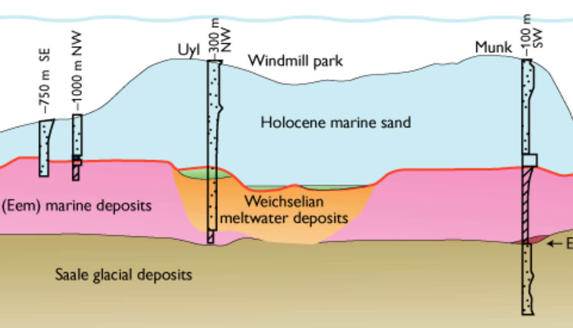
Until recently, studies of the regional distribution of seabed sediments off the littoral zone of the Danish North Sea coast had been concentrated on the Jutland Bank area (Fig. 1; Leth 1996, 1998). Knowledge on the sedimentary conditions and processes along the entire west coast of Jutland has, however, significantly increased as a result of 2000 km of newly acquired high-resolution seismic and side-scan sonar data, supplemented by about 100 vibrocores. These data were collected by the Geological Survey of Denmark and Greenland (GEUS) during joint projects with the Danish Coastal Authority between 1998 and 2001 (Leth et al. 1999; Larsen & Leth 2001). The coastal zone off west Jutland displays a highly dynamic environment, where sediment transport is governed by strong tidal and wave-induced currents. The net wave-generated current is south going, while the coastal current has a net direction towards the north (Knudsen et al. 2002). The direction of the net littoral drift is southward from the outlet of Limfjorden to Blåvands Huk, with net erosion north of Nymindegab and aggregation to the south; the offshore part of this depositional system has recently been studied (Larsen & Leth 2001).
How to Cite
Share
Downloads
Editors: Martin Sønderholm & A.K. Higgins
The Review of Survey activities presents a selection of 23 papers reflecting the wide spectrum of activities of the Geological Survey of Denmark and Greenland, from the microbial to the plate tectonic level.
The Survey's activities in Denmark are documented by ten papers. These include discussion of the [...]