How to Cite


Share

This work is licensed under a Creative Commons Attribution 4.0 International License.
Abstract
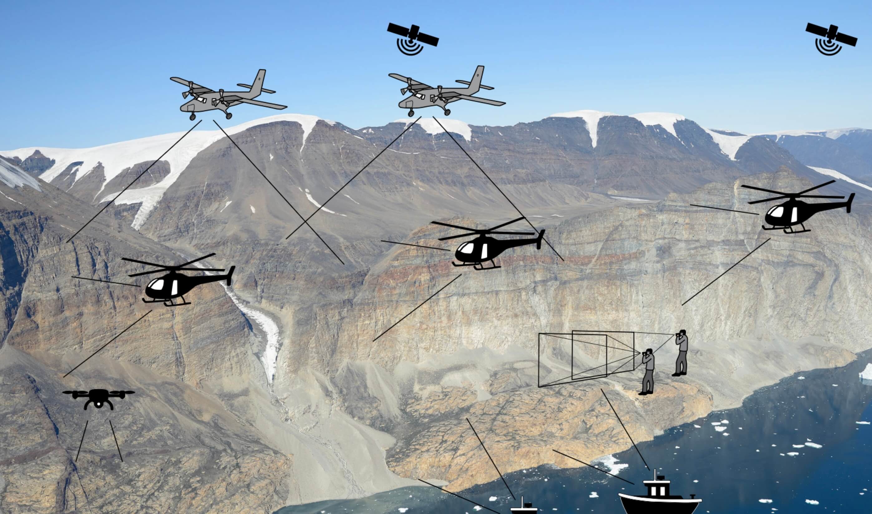
Photogrammetry is a classical remote sensing technique dating back to the 19th century that allows geologists to make three-dimensional observations in two-dimensional images using human stereopsis. Pioneering work in the 1980s and 1990s (Dueholm 1992) combined the use of vertical (nadirlooking) aerial photographs with oblique stereo images from handheld small-frame cameras into so-called multi-model photogrammetry. This was a huge technological step forward that made it possible to map, in three dimensions, steep terrain that would otherwise be inaccessible or poorly resolved in conventional nadir-looking imagery. The development was fundamental to the mapping and investigation of e.g. the Nuussuaq basin (Pedersen et al. 2006). Digital photogrammetry, the all-digital version of multi-model photogrammetry, is nowadays an efficient and powerful geological tool that is used by the Photogeological Laboratory at the Geological Survey of Denmark and Greenland (GEUS) to address geological problems in a range of projects from 3D mapping to image-based surface reconstruction and orthophoto production. Here we present an updated description (complementary to Dueholm 1992) of the analytical procedures in the typical digital workflow used in current 3D mapping projects at GEUS.
How to Cite
Share
Downloads
Editors Adam A. Garde, Ole Bennike and W. Stuart Watt
The 22 contributions in this issue of Review of Survey activities demonstrate the broad field of activities performed by the Geological Survey of Denmark and Greenland and external partners.
Seven papers on Danish geology comprise an investigation of reservoir sandstones for oil [...]