How to Cite


Share

This work is licensed under a Creative Commons Attribution 4.0 International License.
Abstract
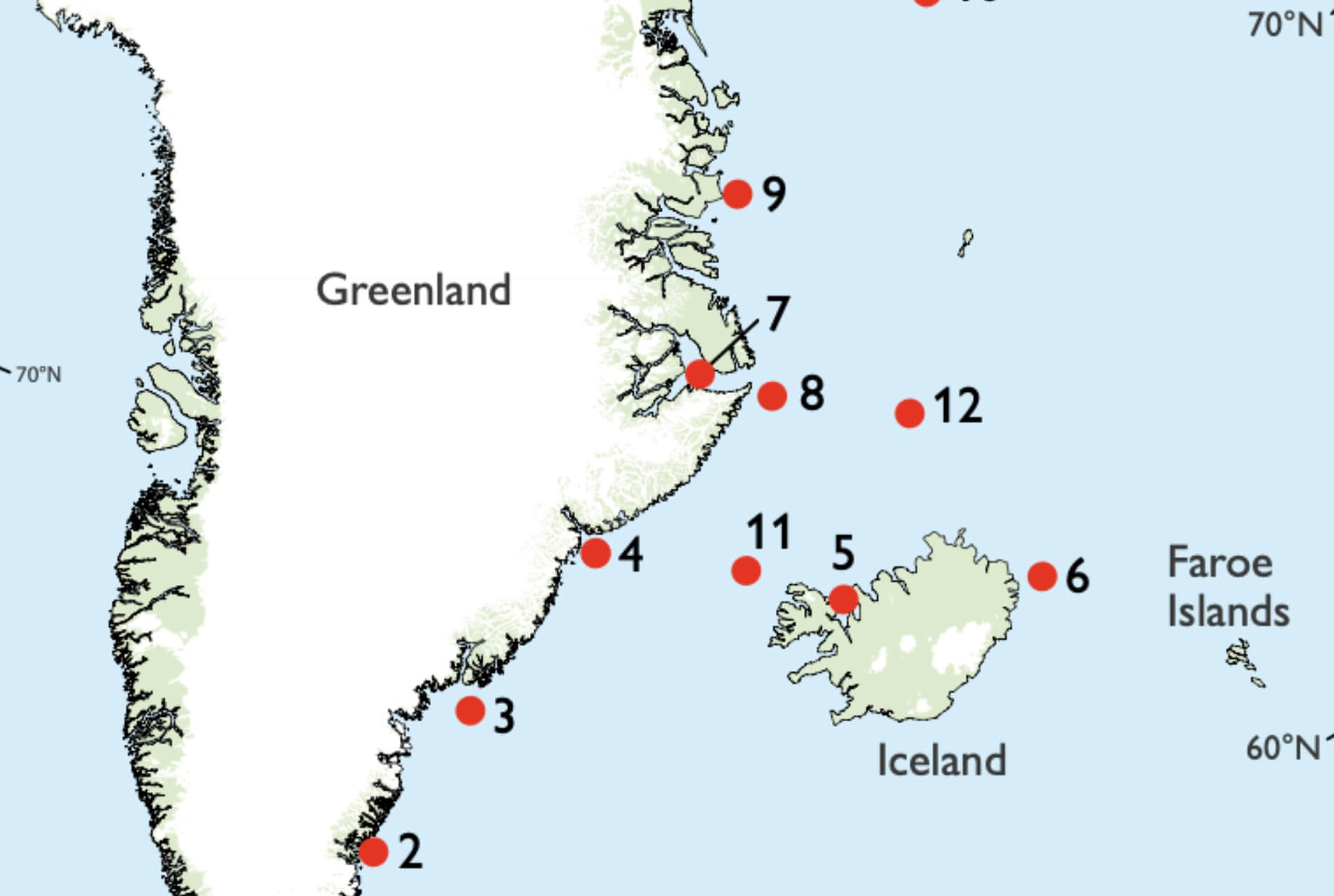
Arctic sea ice has a significant impact on the global radiation budget, oceanic and atmospheric circulation and the stability of the Greenland ice sheet (Vaughan et al. 2013). Prior to the era of aircraft and satellite, information on sea-ice extent relied on observations from ships and people living at the coast. This information is a valuable contribution to better understand the history of sea ice. However, the information exists in a range of formats, e.g., sea-ice extent before the late 1800s is typically reported in the literature as an annual index from a single geographical point or as hand-drawn maps. This makes it difficult to assess and compare data across time and space. The combination of digitised historical maps and single-point data makes the information more accessible and provides a record that can help understand the dynamics and processes of the climate and its interactions with the cryosphere (Chapman & Walsh 1993). In this study, maps of sea-ice extent by Koch (1945) were digitised. We use these maps in combination with sea-ice charts from the Danish Meteorological Institute (DMI) and Koch’s sea-ice index from 1820 to 1939, to map estimated sea-ice extent between Iceland and Greenland going back to 1821. This information has not been included in even the most recent databases of Arctic sea ice (Walsh et al. 2015, 2017). Furthermore, we extract time series of sea-ice extent at a number of locations and investigate the relationship between them. Our observation area is along eastern Greenland, between the southern tip of Greenland at 59°46´N northwards to 77°21´N.
How to Cite
Share
Downloads
Editors Adam A. Garde, Ole Bennike and W. Stuart Watt
The 22 contributions in this issue of Review of Survey activities demonstrate the broad field of activities performed by the Geological Survey of Denmark and Greenland and external partners.
Seven papers on Danish geology comprise an investigation of reservoir sandstones for oil [...]