How to Cite


Share

This work is licensed under a Creative Commons Attribution 4.0 International License.
Abstract
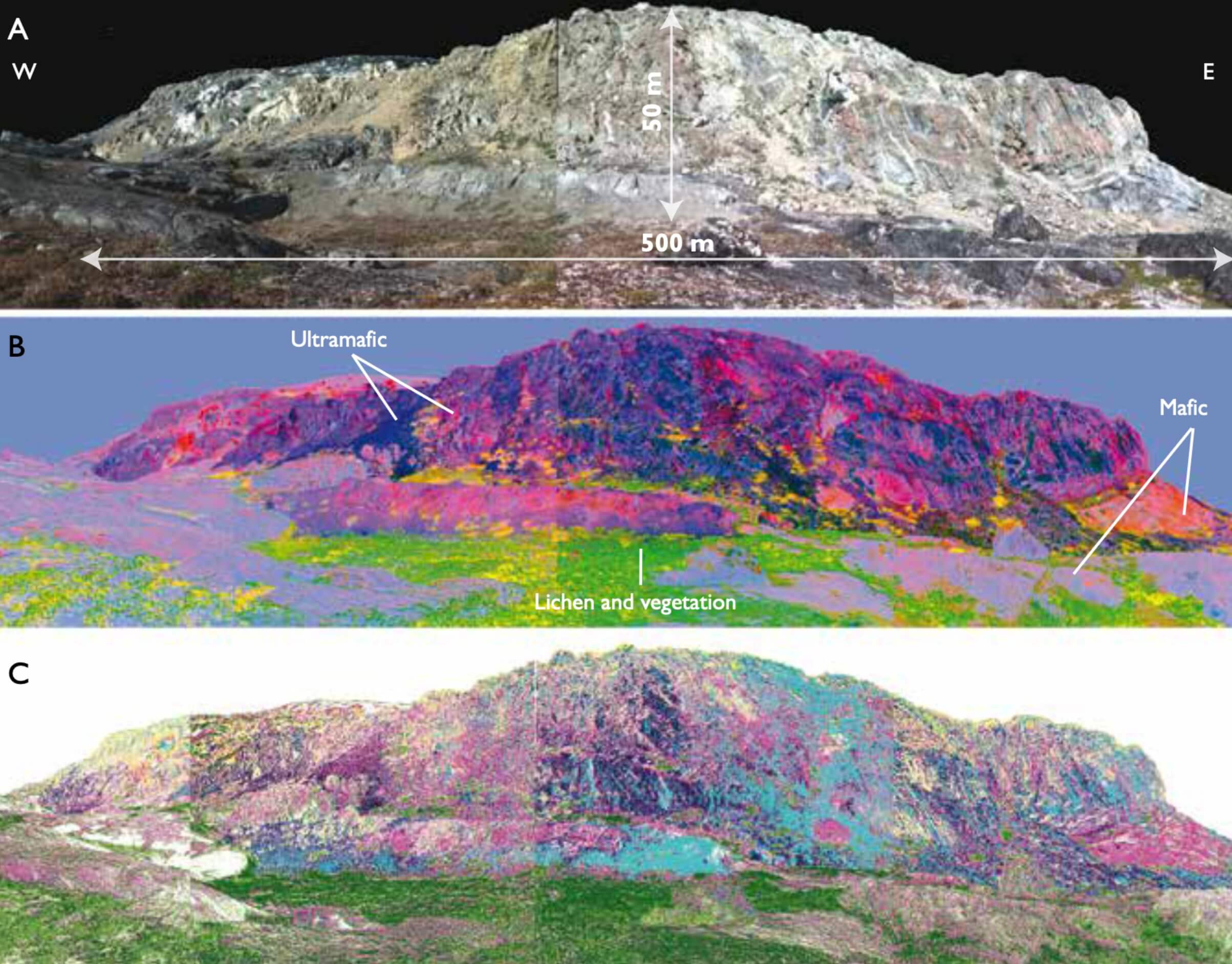
Lithological mapping using remote sensing depends, in part, on the identification of rock types by their spectral characteristics. Chemical and physical properties of minerals and rocks determine their diagnostic spectral features throughout the electromagnetic spectrum. Shifts in the position and changes in the shape and depth of these features can be explained by variations in chemical composition of minerals. Detection of such variations is vital for discriminating minerals with similar chemical composition. Compared with multispectral image data, airborne or spaceborne hyperspectral imagery offers higher spectral resolution, which makes it possible to estimate the mineral composition of the rocks under study without direct contact. Arctic environments provide challenging ground for geological mapping and mineral exploration. Inaccessibility commonly complicates ground surveys, and the presence of ice, vegetation and rock-encrusting lichens hinders remote sensing surveys. This study addresses the following objectives: 1. Modelling the impact of lichen on the spectra of the rock substrate; 2. Identification of a robust lichen index for the deconvolution of lichen and rock mixtures and 3. Multiscale hyperspectral analysis of lithologies in areas with abundant lichens.
How to Cite
Share
Downloads
Editors Adam A. Garde, Ole Bennike and W. Stuart Watt
The 22 contributions in this issue of Review of Survey activities demonstrate the broad field of activities performed by the Geological Survey of Denmark and Greenland and external partners.
Seven papers on Danish geology comprise an investigation of reservoir sandstones for oil [...]