How to Cite


Share

This work is licensed under a Creative Commons Attribution 4.0 International License.
Abstract
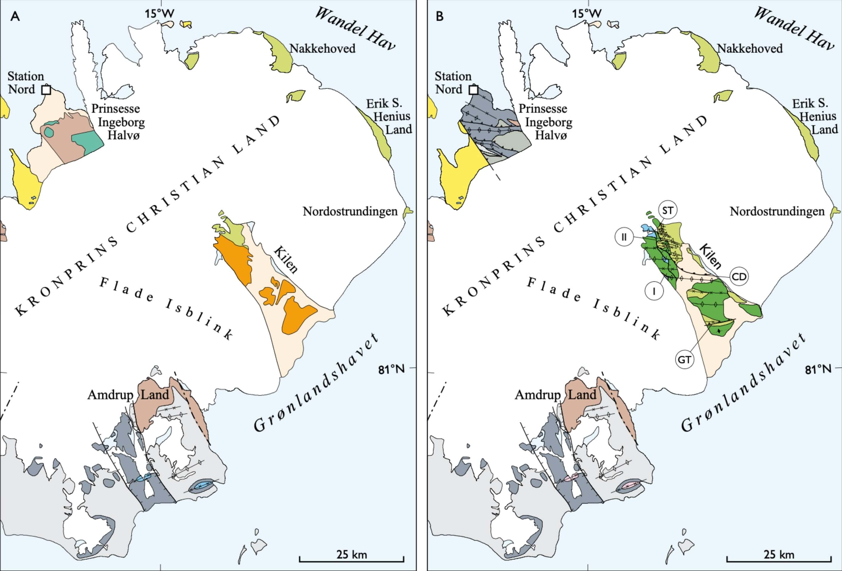
Geological maps are core products of national geological surveys and represent the sum of geological knowledge of any given area. However, dedicated and extensive mapping projects in the Arctic are mostly a thing of the past due to difficulty in financing such costly basic research efforts. Today, an overview of the geology of Greenland is portrayed by a seamless digital 1:500 000 scale geological map (Kokfelt et al. 2013; Pedersen et al. 2013), based on printed maps on this scale produced since 1982 by the Geological Survey of Denmark and Greenland (GEUS; see Holst et al. 2013). The digital map now makes it possible to update smaller areas with new, published or otherwise quality-controlled geological data (e.g. Kolb et al. 2016). This ensures that the map reflects the current state of geological knowledge without undertaking extensive new mapping to update individual map sheets, as has previously been the modus operandi. An online version of the map is available from www.greenmin.dk/map. However, procedures are required to ensure that updates are carried out routinely and that the quality and coherence of the updated map is of the Survey’s standards. Results of recent field work in the Wandel Sea Basin (Fig. 1) and in particular the publication of a new geological map sheet Kilen on a scale of 1:100 000 (Svennevig in press) have implications for the geology shown on the above mentioned 1:500 000 scale seamless geological map of Greenland. The post-Devonian part of this map in eastern North Greenland has been updated according to the results of studies published since the publication of the original printed maps (Bengaard & Henriksen 1986; Jepsen 2000). The changes do not call for an update of the 1:2 500 000 scale geological map of Greenland (Henriksen et al. 2009).
How to Cite
Share
Downloads
Editors Adam A. Garde, Ole Bennike and W. Stuart Watt
The 22 contributions in this issue of Review of Survey activities demonstrate the broad field of activities performed by the Geological Survey of Denmark and Greenland and external partners.
Seven papers on Danish geology comprise an investigation of reservoir sandstones for oil [...]