How to Cite


Share

This work is licensed under a Creative Commons Attribution 4.0 International License.
Abstract
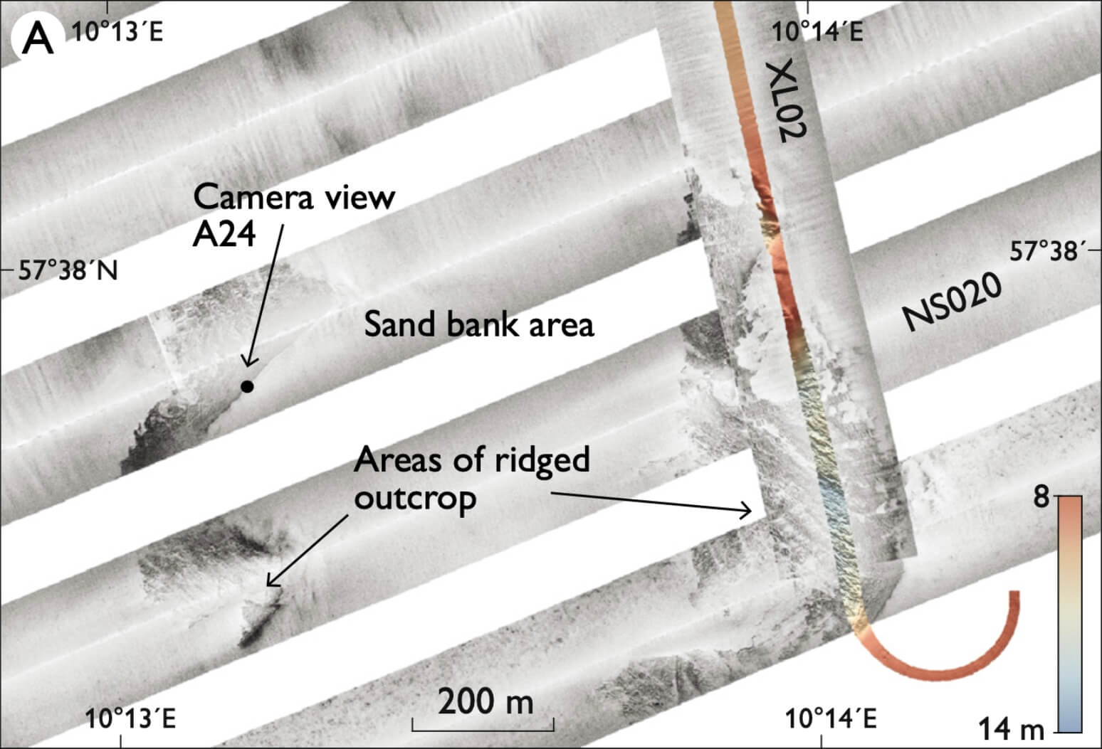
During August 2017, as part of the habitat mapping of Natura2000 areas, a geophysical survey of a large area within the Skagerrak was undertaken by the Geological Survey of Denmark and Greenland. In this article, we use the acquired data to discuss the geology of Tannis Bugt (Fig. 1), a large shallow bay at the north-west coast of Vendsyssel. The bay extends 40 km between Hirtshals in the west and Skagen in the east forming the northern-most Danish Skagerrak coast.
How to Cite
Share
Downloads
Editors Adam A. Garde, Ole Bennike and W. Stuart Watt
The 22 contributions in this issue of Review of Survey activities demonstrate the broad field of activities performed by the Geological Survey of Denmark and Greenland and external partners.
Seven papers on Danish geology comprise an investigation of reservoir sandstones for oil [...]