How to Cite


Share
Copyright (c) 2008 Peter R Dawes, Tapani Tukiainen

This work is licensed under a Creative Commons Attribution 4.0 International License.
Abstract
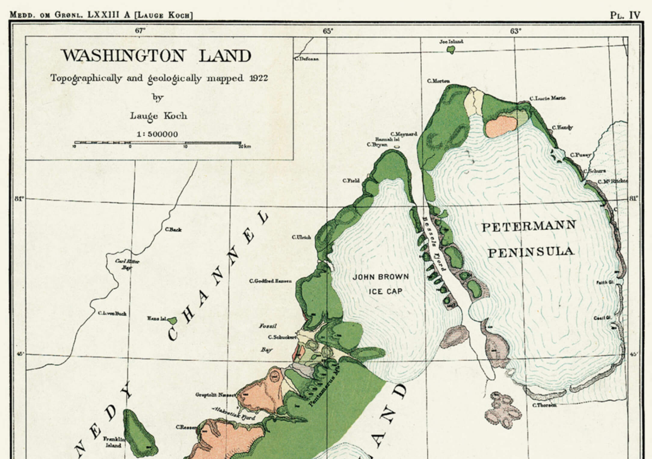
Hans Ø – or Tartupaluk to the indigenous population of North-West Greenland – is a small steeply sided island in Nares Strait at c. 80°50´N. Charted in 1871 and named after Greenlander Hans Hendrik, it is one of five limestone islands forming an integral part of the Greenland Silurian succession. Rising less than 170 m above normally ice-infested waters, the 1.25 km2 island is physiographically far overshadowed by nearby Franklin Ø (Fig. 1). The island’s notoriety results from its placing more or less equidistant between the coasts of Kennedy Channel on the political boundary between Greenland and Canada. For 40 years the rocky patch has been the subject of a dispute be tween the Danish/Greenland and Canadian governments regarding sovereignty rights, an issue that remains unresolved. However, there is mutual understanding between Canada and Denmark that “since the question of sovereignty over the island has not yet been solved no action should be taken by either side which might prejudge the settlement of the issue” (Brückner 1984). Formally, this remains the position today.
How to Cite
Share
Copyright (c) 2008 Peter R Dawes, Tapani Tukiainen
This work is licensed under a Creative Commons Attribution 4.0 International License.
Downloads
Edited by Ole Bennike and A.K. Higgins
This Review of Survey activities presents a selection of 22 papers reflecting the wide spectrum of activities of the Geological Survey of Denmark and Greenland, from the microscopic to the plate-tectonic level.
The Survey's activities in Denmark are illustrated by 13 articles. Five of them deal with petroleum-related [...]