How to Cite


Share
Copyright (c) 2008 Birgitte Hansen, Lærke Thorling

This work is licensed under a Creative Commons Attribution 4.0 International License.
Abstract
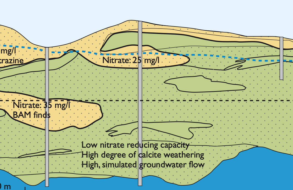
The principal aim of mapping ground-water vulnerability in Denmark is to ensure optimal protection of present and future drinking-water resources. Groundwater vulnerability mapping of areas up to 1000 km2 has been taking place over the past seven years. The scale of mapping has been adjusted to meet the demands for details of regulation of land use requested by Danish legislation. Groundwater vulnerability mapping comprises analyses and integration of geological, geophysical, hydrological and geochemical data. This paper focuses on the geochemical reactions between groundwater and sediment. Geochemical knowledge may sometimes not be fully and systematically utilised in groundwater vulnerability mapping. This paper presents different geochemical approaches and demonstrates how these can be successfully integrated with geological, geophysical and hydrological data.
How to Cite
Share
Copyright (c) 2008 Birgitte Hansen, Lærke Thorling
This work is licensed under a Creative Commons Attribution 4.0 International License.
Downloads
Edited by Ole Bennike and A.K. Higgins
This Review of Survey activities presents a selection of 22 papers reflecting the wide spectrum of activities of the Geological Survey of Denmark and Greenland, from the microscopic to the plate-tectonic level.
The Survey's activities in Denmark are illustrated by 13 articles. Five of them deal with petroleum-related [...]