How to Cite


Share
Copyright (c) 2009 Peter R. Dawes

This work is licensed under a Creative Commons Attribution 4.0 International License.
Abstract
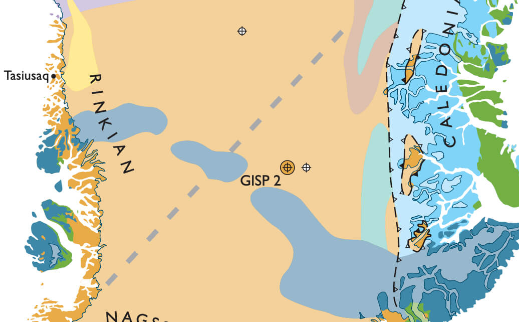
Geological maps are of vital importance for documenting and advancing geological knowledge and they are a prerequisite for any meaningful evaluation of economic resources. In Greenland, mapping is taking place on the mainland – that for two centuries has been the traditional exploration target – and offshore, where only in the last decades has hydrocarbon exploration moved to the continental shelves. Greenland with its 2 166 000 km2 is the largest island in the world. However, the land is overwhelmed by ice. A central ice sheet – the Inland Ice – blankets some 81% of the country reducing rock outcrop to a coastal fringe 0 to 300 km wide (Fig. 1). The continental shelves comprise a little more than twice the area of this fringe, c. 830 000 km2. This preamble serves to emphasise that Greenland’s three physiographic units – exposed fringe, offshore and Inland Ice – are of very different size and that mapping has focused on the smallest acreage. Piecing together the composition of the largest, and hitherto unexplored, unit constitutes the next chapter of Greenland mapping.
How to Cite
Share
Copyright (c) 2009 Peter R. Dawes
This work is licensed under a Creative Commons Attribution 4.0 International License.
Downloads
Edited by Ole Bennike, Adam A. Garde and W. Stuart Watt
This Review of Survey activities presents a selection of 19 papers reflecting the wide spectrum of activities of the Geological Survey of Denmark and Greenland, including field-based, laboratory and remote sensing studies.
The Survey's activities in Denmark are illustrated by ten articles covering the [...]