How to Cite


Share
Copyright (c) 2009 Ingelise Møller, Verner H Søndergaard, Flemming Jørgensen

This work is licensed under a Creative Commons Attribution 4.0 International License.
Abstract
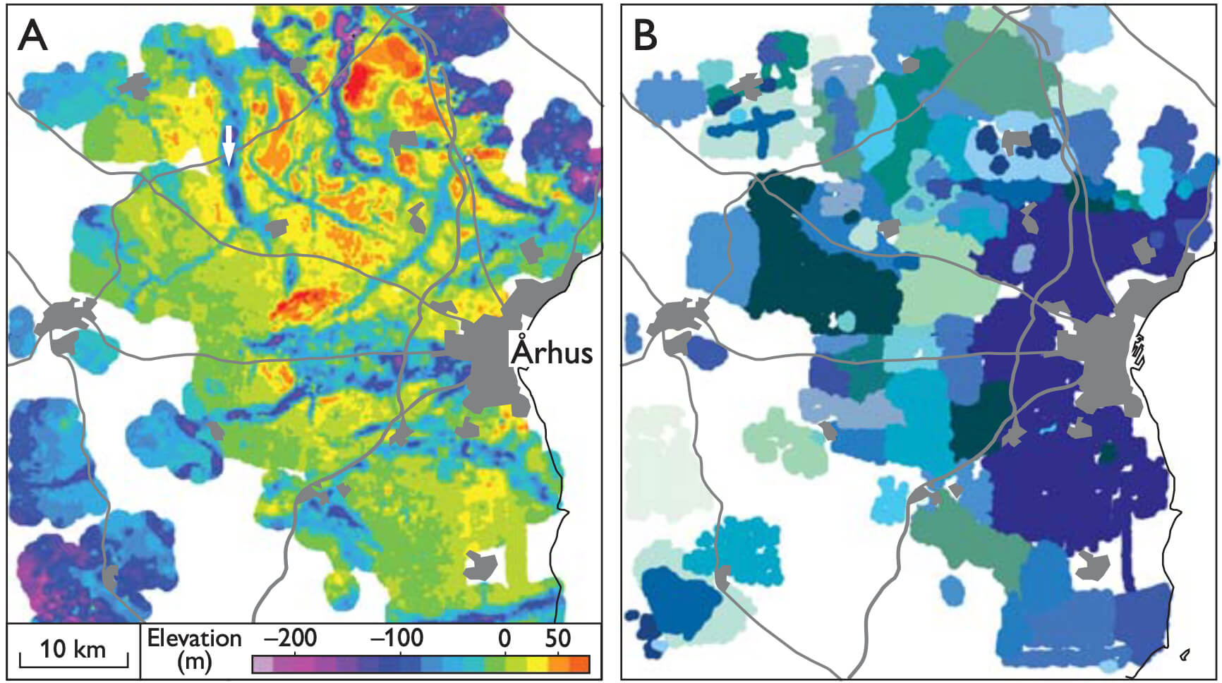
Groundwater mapping in Denmark has high priority. It was initiated in the 1990s when the pressure on groundwater resources increased due to urban development and pollution from industrial and agricultural sources. In some areas, the groundwater mapping included survey drillings, modelling based on existing knowledge and geophysical mapping with newly developed methods that made area coverage on a large scale possible. The groundwater mapping that included development of new geophysical methods showed promising results, and led to an ambitious plan to significantly intensify the hydrogeological mapping in order to improve the protection of the Danish groundwater resources. In 1999 the Danish Government initiated the National Groundwater Mapping Programme with the objective to obtain a detailed description of the aquifers with respect to localisation, extension, distribution and interconnection as well as their vulnerability to pollution (Thomsen et al. 2004). This mapping programme covers around 40% of the area of Denmark designated as particularly valuable water abstraction areas. Water consumers finance the mapping programme by paying 0.04 € per cubic metre of consumed water. At the end of the programme in 2015, the total cost is estimated to be about 250 000 000 € with a significant part spent on geophysical mapping.
How to Cite
Share
Copyright (c) 2009 Ingelise Møller, Verner H Søndergaard, Flemming Jørgensen
This work is licensed under a Creative Commons Attribution 4.0 International License.
Downloads
Edited by Ole Bennike, Adam A. Garde and W. Stuart Watt
This Review of Survey activities presents a selection of 19 papers reflecting the wide spectrum of activities of the Geological Survey of Denmark and Greenland, including field-based, laboratory and remote sensing studies.
The Survey's activities in Denmark are illustrated by ten articles covering the [...]