How to Cite


Share
Copyright (c) 2010 Tapani Tukiainen, Bjørn Thomassen

This work is licensed under a Creative Commons Attribution 4.0 International License.
Abstract
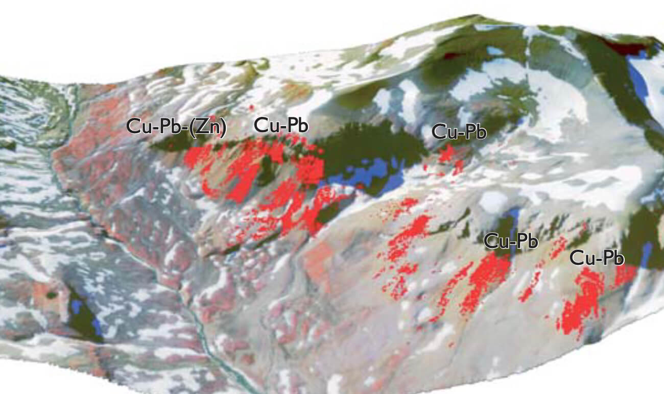
An airborne hyperspectral survey was organised by the Geological Survey of Denmark and Greenland (GEUS) and carried out in 2000 to test the use of spectral analysis in mineral exploration under Arctic conditions. The hyperspectral data were acquired by using the HyMap imaging system consisting of sensors that collect reflected solar radiation in 126 bands covering the 440–2500 nm wavelength range (Bedini & Tukiainen 2008). The spatial resolution was 4 × 4 m (Tukiainen 2001). Eight sites underlain by Caledonian or post-Caledonian rocks with known mineral occurrences (Fig. 1) were tested. The project was financially supported by the Greenland Bureau of Minerals and Petroleum and the data were analysed by GEUS. Here we provide a summary of the results.
How to Cite
Share
Copyright (c) 2010 Tapani Tukiainen, Bjørn Thomassen
This work is licensed under a Creative Commons Attribution 4.0 International License.
Downloads
Edited by Ole Bennike, Adam A. Garde and W. Stuart Watt
This Review of Survey activities presents a selection of 23 papers reflecting the wide spectrum of activities of the Geological Survey of Denmark and Greenland, from the microscopic to the plate-tectonic level. In addition, an obituary about the former director of the [...]