How to Cite


Share
Copyright (c) 2010 Bo Møller Stensgaard, Jochen Kolb, Troels F.D. Nielsen, Símun D. Olsen, Llewellyn Pilbeam, Diana Lieber, Anette Clausen

This work is licensed under a Creative Commons Attribution 4.0 International License.
Abstract
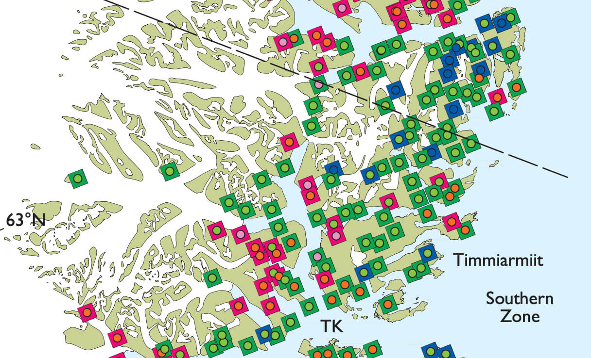
South-East Greenland between 62°N and 67°N is one of the lesser known regions in Greenland, having seen only limited geological investigations and only few detailed ones, with the Skjoldungen alkaline igneous province as a notable exception (Nielsen & Rosing 1990). Systematically collected geoscientific data are scarce; however, such data are essential as a basis for geological models and for evaluation of the mineral potential. In order to open up the region for exploration, the Greenland Bureau of Minerals and Petroleum financed a two-year, mainly geochemical programme for 2009 and 2010, which is an initial part of a five to six year project that involves subsequent geophysical surveys, a geological programme and a full-scale resource assessment of the region. The primary objective of the initial geochemical programme is to collect sediment samples for analysis of chemistry and indicator minerals. Supplementary to this, surface water for chemistry is collected and radiometric spectra of representative lithologies are measured. Geological reconnaissance field work focussing on selected key areas is also carried out.
How to Cite
Share
Copyright (c) 2010 Bo Møller Stensgaard, Jochen Kolb, Troels F.D. Nielsen, Símun D. Olsen, Llewellyn Pilbeam, Diana Lieber, Anette Clausen
This work is licensed under a Creative Commons Attribution 4.0 International License.
Downloads
Edited by Ole Bennike, Adam A. Garde and W. Stuart Watt
This Review of Survey activities presents a selection of 23 papers reflecting the wide spectrum of activities of the Geological Survey of Denmark and Greenland, from the microscopic to the plate-tectonic level. In addition, an obituary about the former director of the [...]