How to Cite


Share
Copyright (c) 2016 Ulrik Gregersen, Paul C Knutz, John R Hopper

This work is licensed under a Creative Commons Attribution 4.0 International License.
Abstract
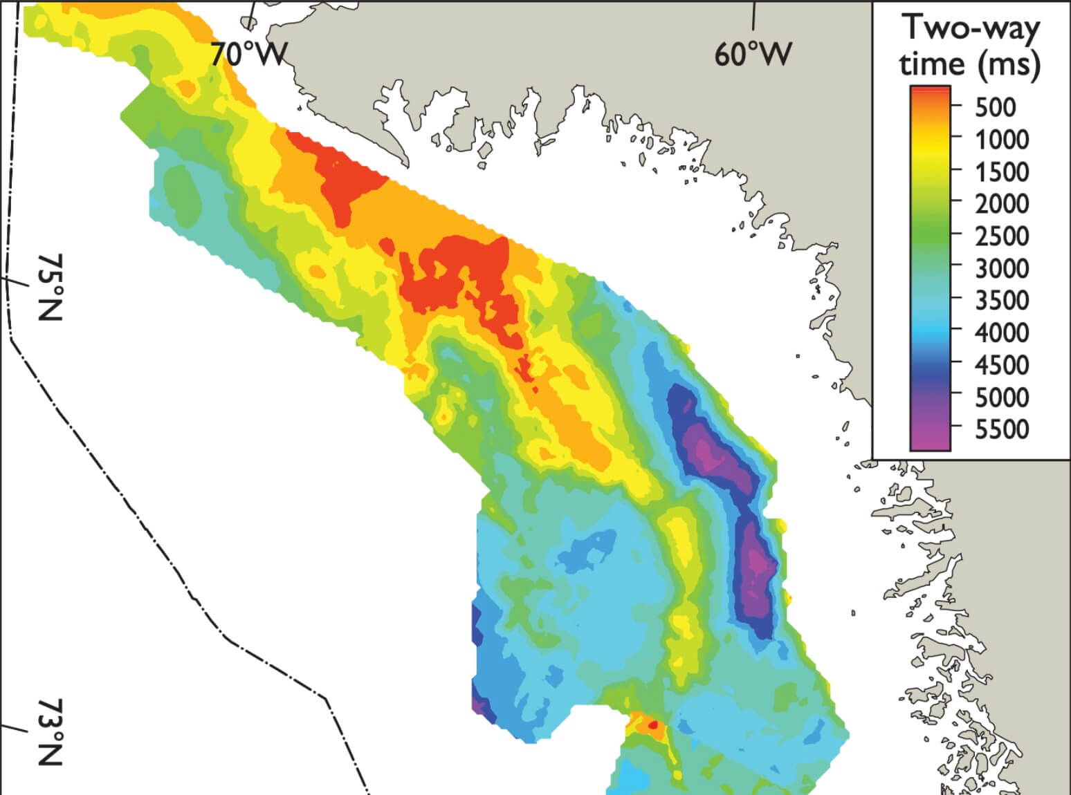
The Geological Survey of Denmark and Greenland has carried out a detailed mapping project in the eastern Baffin Bay region covering c. 200 000 km2 (Fig. 1). The purpose of the study was to update the previous mapping by using the most recent data and provide an improved basis for evaluation of the geological development and hydrocarbon potential of the region. After licensing rounds in 2007–2008 and 2010 considerable new geophysical and geological data were acquired in the region, and the extensive database now includes more than 100 000 km 2D seismic data and a number of wells (Fig. 1). The results of the work are summarised below and suggest deep basins and large ridges with complex structures.
How to Cite
Share
Copyright (c) 2016 Ulrik Gregersen, Paul C Knutz, John R Hopper
This work is licensed under a Creative Commons Attribution 4.0 International License.
Downloads
Editors Adam A. Garde, Ole Bennike, Kristine Thrane and W. Stuart Watt
This issue of Review of Survey Activities presents a selection of 24 papers reflecting the wide spectrum of current activities of the Geological Survey of Denmark and Greenland, from the microscopic to the plate-tectonic level.
The Survey’s activities in Denmark are illustrated [...]