How to Cite


Share
Copyright (c) 2016 Niels Nørgaard-Pedersen, Sofia Ribeiro, Naja Mikkelsen, Audrey Limoges, Marit-Solveig Seidenkrantz

This work is licensed under a Creative Commons Attribution 4.0 International License.
Abstract
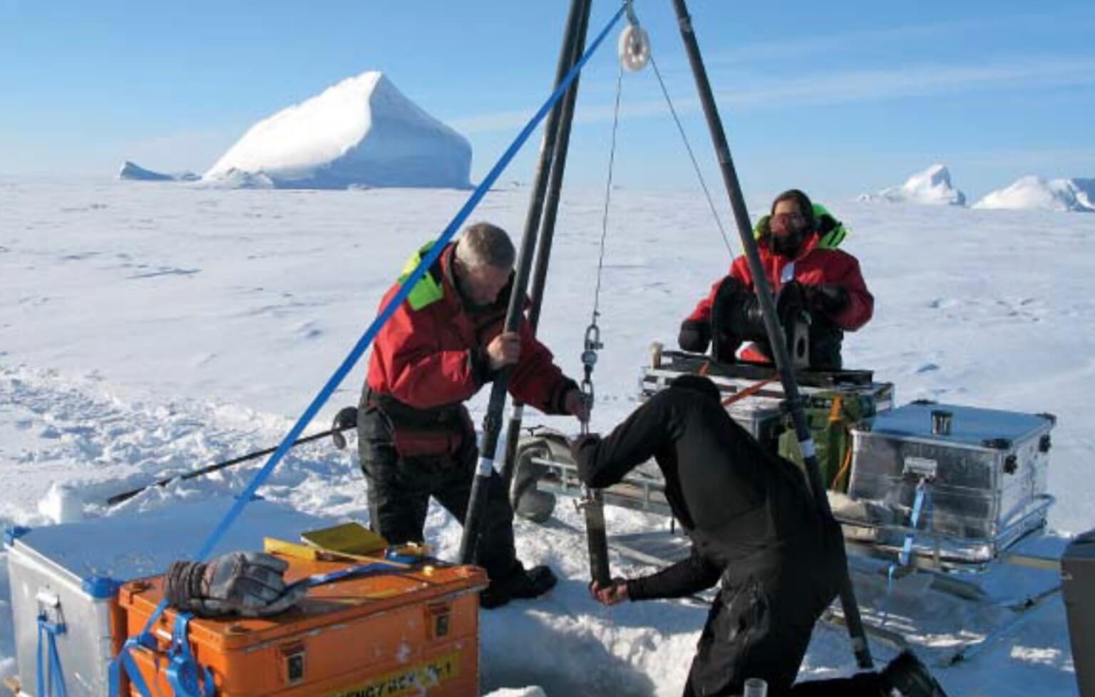
The marine record of the Independence–Danmark fjord system extending out to the Wandel Hav in eastern North Greenland (Fig. 1A) is little known due to the almost perennial sea-ice cover, which makes the region inaccessible for research vessels (Nørgaard-Pedersen et al. 2008), and only a few depth measurements have been conducted in the area. In 2015, the Villum Research Station, a new logistic base for scientific investigations, was opened at Station Nord. In contrast to the early exploration of the region, it is now possible to observe and track the seasonal character and changes of ice in the fjord system and the Arctic Ocean through remote sensing by satellite radar systems. Satellite data going back to the early 1980s show that the outer part of the Independence–Danmark fjord system is characterised by perennial sea ice whereas both the southern part of the fjord system and an area 20–30 km west of Station Nord are partly ice free during late summer (Fig. 1B). Hence, marine-orientated field work can be conducted from the sea ice using snow mobiles, and by drilling through the ice to reach the underlying water and sea bottom.
How to Cite
Share
Copyright (c) 2016 Niels Nørgaard-Pedersen, Sofia Ribeiro, Naja Mikkelsen, Audrey Limoges, Marit-Solveig Seidenkrantz
This work is licensed under a Creative Commons Attribution 4.0 International License.
Downloads
Editors Adam A. Garde, Ole Bennike, Kristine Thrane and W. Stuart Watt
This issue of Review of Survey Activities presents a selection of 24 papers reflecting the wide spectrum of current activities of the Geological Survey of Denmark and Greenland, from the microscopic to the plate-tectonic level.
The Survey’s activities in Denmark are illustrated [...]