How to Cite


Share

This work is licensed under a Creative Commons Attribution 4.0 International License.
Abstract
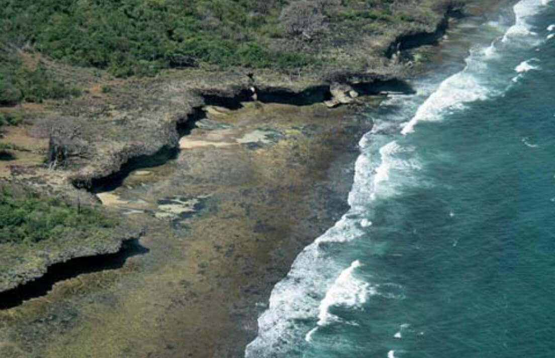
The Kenya coastline extends 600 km from the border of Tanzania in the south to the border of Somalia in the north (Fig. 1). The Kenyan coast features a diverse marine environment, including estuaries, mangroves, sea grass beds and intertidal reef platforms and coral reefs, which are vital for the reproduction of marine organisms. These coastal ecosystems are regarded as some of the most valuable in Kenya but face serious threats from the ever increasing human pressure of tourism, industrial pollution, destructive fishing, mangrove logging and other unsustainable uses of marine resources. Another serious threat is the maritime transportation activities along the coast and at the ports. It is estimated that at any given time more than 50 ships operate in the major shipping lanes off the Kenyan coast, of which about nine are oil tankers with capacities ranging from 50 000 to 250 000 tonnes. Furthermore, the harbour of Mombasa serves as the major port for countries in East Africa. In recognition of the risks posed by oil pollution the government of Kenya and the commercial petroleum industry agreed to develop a National Oil Spill Response Contingency Plan (NOSRCP) with the purpose of enabling a speedy and effective response to any oil spill within the territorial waters of Kenya. An important element of this plan was the mapping of the coastal resources and the development of an environmental sensitivity atlas showing the vulnerability of the coast to marine oil spills. In 2004, the Government of Kenya approached the United Nations Development Program (UNDP) in Kenya for financial support to develop an environmental sensitivity atlas. The project was approved and forwarded for funding by the Danish Consultancy Trust Fund administrated by United Nations Operational Program (UNOPS) in Copenhagen. The project was announced in Denmark, and the KenSea group headed by the Geological Survey of Denmark and Greenland (GEUS) was awarded the contract. The project comprises four phases: (1) data compilation and development of the KenSea database, (2) development of a coastal classification for Kenya, (3) development of the sensitivity index jointly with a group of stakeholders, and (4) compilation of the KenSea environmental sensitivity atlas (Tychsen 2006).
How to Cite
Share
Downloads
Editors: Martin Sønderholm & A.K. Higgins
The Review of Survey activities presents a selection of 15 papers reflecting the wide spectrum of activities of the Geological Survey of Denmark and Greenland, from the microscopic to the plate tectonic level.
Activities in Denmark: The Survey's field of activities in Denmark is illustrated by four papers on [...]