How to Cite


Share

This work is licensed under a Creative Commons Attribution 4.0 International License.
Abstract
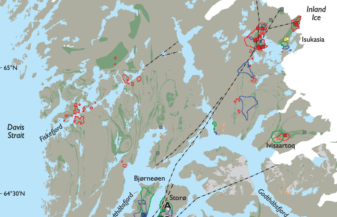
Visual inspection and comparison of lithological, topographical, geochemical and geophysical maps is a necessary (and often successful) way of interpreting geological features across poorly exposed or poorly explored areas. In mineral exploration, geochemical and geophysical maps are used to visually identify anomalies believed to reflect mineral occurrences. Outcropping mineral occurrences of a certain size can produce elevated concentrations of elements in stream sediment samples, or create magnetic or radioactive signals retrievable by airborne surveys. However, if the regional data are widely spaced, and if the occurrences are small or poorly exposed, the anomalies created may be too subtle to be recognised visually. In such cases, statistical data analyses may help identify deviations from background variations and trends in the data. Furthermore, visually based correlation between distribution patterns on maps is often limited to a few parameters, and multi-variable relationships are easily overlooked or not possible to deduce. Gold occurrences in Greenland occur in specific host rocks as a result of mineralising processes, e.g. hydrothermal activity, that have affected a larger area. Thus, the favourable environment for a gold occurrence may be reflected in regional scale survey data as subtle changes in certain geochemical and geophysical properties. If such changes, i.e. a multi-parameter signature for gold mineralisation, can be identified, the regional data can be searched for areas that might hold the same signature. This paper presents results gained in the application of a statistical spatial analysis method to investigate how known gold showings are expressed in a range of regional datasets from the Nuuk region, southern West Greenland. The main objective is to identify new areas with gold potential, and to quantify the signatures of the showings. The first tests based on this approach were reported in Nielsen et al. (2004) and Steensgaard et al. (2006).
How to Cite
Share
Downloads
Editors: Martin Sønderholm & A.K. Higgins
The Review of Survey activities presents a selection of 15 papers reflecting the wide spectrum of activities of the Geological Survey of Denmark and Greenland, from the microscopic to the plate tectonic level.
Activities in Denmark: The Survey's field of activities in Denmark is illustrated by four papers on [...]