How to Cite


Share
Copyright (c) 2010 Jørgen O. Leth, Bernhard Novak

This work is licensed under a Creative Commons Attribution 4.0 International License.
Abstract
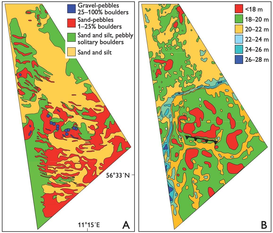
Following the proposal of the offshore Anholt wind-farm project with an energy capacity of 400 megawatt in the Kattegat, southern Scandinavia, an evaluation of the geotechnical properties of the subsurface of the area is required. As a first step to map the seabed geology the Geological Survey of Denmark and Greenland (GEUS) conducted a geophysical survey (Leth et al. 2009) which, together with cone penetration tests and data from boreholes, lead to a greater understanding of the geological architecture and development of the 144 km2 survey area (Figs 1, 2).
How to Cite
Share
Copyright (c) 2010 Jørgen O. Leth, Bernhard Novak
This work is licensed under a Creative Commons Attribution 4.0 International License.
Downloads
Edited by Ole Bennike, Adam A. Garde and W. Stuart Watt
This Review of Survey activities presents a selection of 23 papers reflecting the wide spectrum of activities of the Geological Survey of Denmark and Greenland, from the microscopic to the plate-tectonic level. In addition, an obituary about the former director of the [...]