How to Cite


Share
Copyright (c) 2011 Stig A. Schack Pedersen, Geraint Cooksley, Marc Gaset, Peter Roll Jakobsen

This work is licensed under a Creative Commons Attribution 4.0 International License.
Abstract
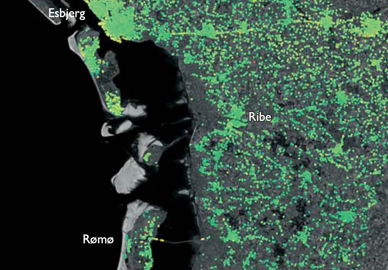
Since 1991, a number of European satellites have acquired data of the Earth’s surface for environmental monitoring. In general, a satellite will orbit the Earth in about 1½ hours and it takes 35 days before an ERS or ENVISAT satellite repeats radar scanning of the same position. For younger generations of satellites, such as RADARSAT and TERRA, the scanning repeat interval has decreased to 24 and 11 days, respectively, so that hundreds of radar scenes of the same place, produced over the past c. 20 years, are now available.
How to Cite
Share
Copyright (c) 2011 Stig A. Schack Pedersen, Geraint Cooksley, Marc Gaset, Peter Roll Jakobsen
This work is licensed under a Creative Commons Attribution 4.0 International License.
Downloads
Edited by Ole Bennike, Adam A. Garde and W. Stuart Watt
This Review of Survey activities presents a selection of 19 papers reflecting the wide spectrum of activities of the Geological Survey of Denmark and Greenland, from the microscopic to the plate-tectonic level.
The Survey's activities in Denmark and surrounding areas are [...]