How to Cite
Share
Abstract
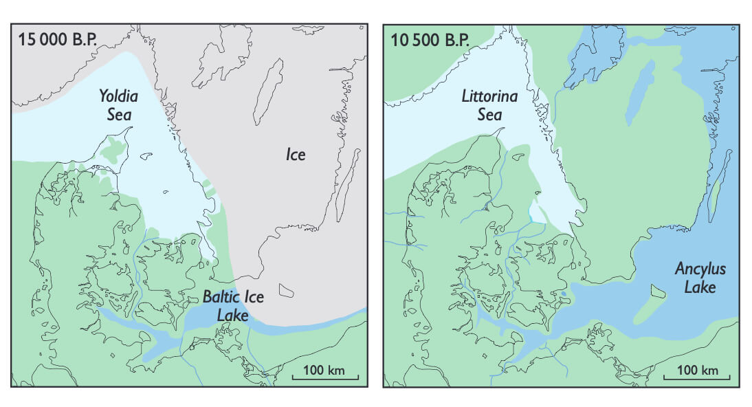
The present-day Storebælt (Great Belt), the waterway between the islands of Fyn and Sjælland (Fig. 1), contains deeply incised valleys, locally more than 50 m deep, and is of crucial importance to the water exchange between the fully marine Kattegat and the brackish Baltic Sea. The role of this important gateway changed significantly during the late and post-glacial period (since 15000 B.P.), when the Baltic Basin experienced alternating freshwater, brackish and marine conditions as a result of changes in relative sea level (Figs 2, 3). The importance of the Storebælt in understanding the dynamics of the Baltic Basin is reflected in the large number of studies carried out (see Bennike et al. 2004). The first detailed sedimentological and stratigraphic studies in the Storebælt area that demonstrated the presence of early Holocene freshwater deposits below the seabed were those of Krog (1960, 1965, 1971), who also presented the first shore-displacement curve for the area (Krog 1979).
How to Cite
Share
Downloads
Editors: Martin Sønderholm & A.K. Higgins
The Review of Survey activities presents a selection of 18 papers reflecting the wide spectrum of activities of the Geological Survey of Denmark and Greenland, from the microbial to the plate tectonic level.
Activities in Denmark: The Survey's activities in Denmark are documented by 11 papers. The main themes [...]


