How to Cite


Share
Copyright (c) 2011 Jørn Bo Jensen, Sara Borre, Jørgen O. Leth, Zyad Al-Hamdani, Laura G. Addington

This work is licensed under a Creative Commons Attribution 4.0 International License.
Abstract
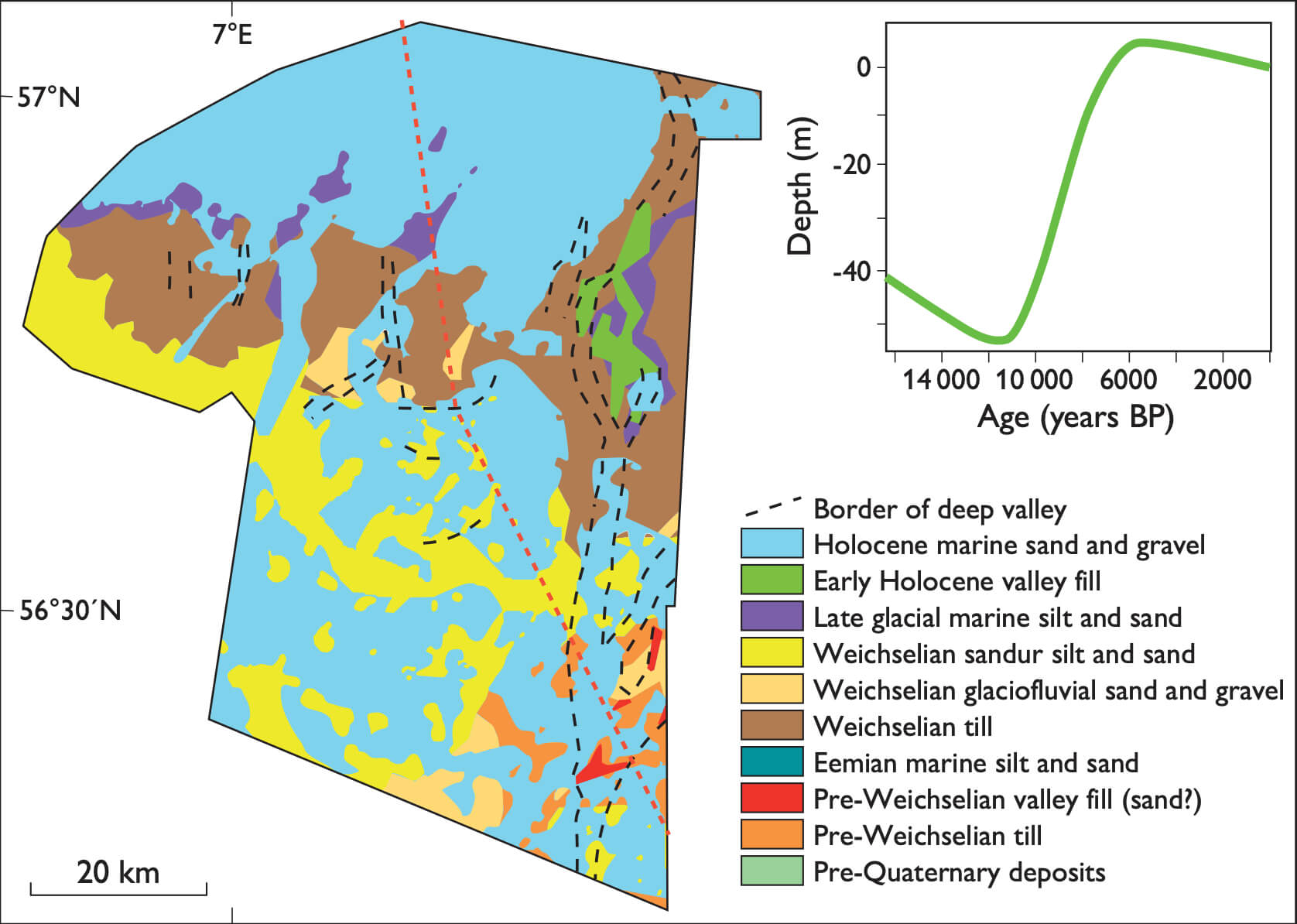
In the summer of 2010, the Geological Survey of Denmark and Greenland (GEUS) mapped the potential raw materials and substrate types, over large parts of the Danish economic sector of the North Sea, in cooperation with Orbicon A/S. The mapping was carried out for the Danish Nature Agency; it is part of the general mapping of raw material resources within the territories of the Danish state and forms part of the input for the implementation of the European Union’s Marine Strategy Framework Directive. The purpose was (1) to provide an overview of the distribution, volume and composition of available raw materials and (2) to identify, describe and map the distribution of the dominant marine bottom types.
How to Cite
Share
Copyright (c) 2011 Jørn Bo Jensen, Sara Borre, Jørgen O. Leth, Zyad Al-Hamdani, Laura G. Addington
This work is licensed under a Creative Commons Attribution 4.0 International License.
Downloads
Edited by Ole Bennike, Adam A. Garde and W. Stuart Watt
This Review of Survey activities presents a selection of 19 papers reflecting the wide spectrum of activities of the Geological Survey of Denmark and Greenland, from the microscopic to the plate-tectonic level.
The Survey's activities in Denmark and surrounding areas are [...]