How to Cite


Share
Copyright (c) 2011 Margrethe Kristensen, Thomas Vangkilde-Pedersen, Erik Skovbjerg Rasmussen

This work is licensed under a Creative Commons Attribution 4.0 International License.
Abstract
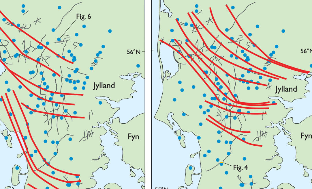
A major hydrogeological programme has been carried out to map the Miocene succession in central and southern Jylland (Fig. 1). The Miocene deposits comprise several aquifers with potential drinking water resources and have been investigated by drilling and acquisition of seismic data integrated with sedimentology and biostratigraphy. Scharling et al. (2009) described a 3D hydrogeological model that covers part of the onshore Danish Miocene deposits. The model was based on a sequence-stratigraphic approach and led to a better understanding of the geological architecture of the aquifers than traditional lithofacies models. Hence it was decided to establish a digital, spatial, geological model covering the entire onshore Miocene succession (Kristensen et al. 2010).
How to Cite
Share
Copyright (c) 2011 Margrethe Kristensen, Thomas Vangkilde-Pedersen, Erik Skovbjerg Rasmussen
This work is licensed under a Creative Commons Attribution 4.0 International License.
Downloads
Edited by Ole Bennike, Adam A. Garde and W. Stuart Watt
This Review of Survey activities presents a selection of 19 papers reflecting the wide spectrum of activities of the Geological Survey of Denmark and Greenland, from the microscopic to the plate-tectonic level.
The Survey's activities in Denmark and surrounding areas are [...]