How to Cite


Share
Copyright (c) 2012 Michael B.W. Fyhn, Thorkild M. Rasmussen, Trine Dahl-Jensen, Willy L. Weng, Jørgen A. Bojesen-Koefoed, Tove Nielsen

This work is licensed under a Creative Commons Attribution 4.0 International License.
Abstract
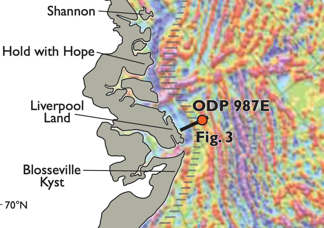
The East Greenland margin consists of a number of sedimentary basins, platforms and structural highs (Figs 1, 2). Due to the challenges imposed by the Arctic climate, the region is in an early stage of exploration, and knowledge of the geology and petroleum potential of the margin is limited. However, the significant prospectivity of the conjugated European North Atlantic margin and the nature of the North-East Greenland onshore geology prompt for future offshore exploration. The US Geological Survey thus highlighted the North-East Greenland margin in their latest assessment of the Arctic region (Gautier et al. 2011). With a mean estimate of undiscovered recoverable oil, gas, and natural gas liquids of approximately 31 billion barrels of oil equivalents, the US Geological Survey ranked the North-East Greenland margin fourth in the entire Arctic region, only superseded by known producing petroleum provinces.
In preparation for the initial East Greenland licence rounds in 2012 and 2013 the Geological Survey of Denmark and Greenland gathers geological information on the margin necessary for the decision process of the Greenland authorities regarding exploration. Geophysical analyses complemented by well-data, onshore geology and information from the conjugated Atlantic margin form the backbone of the study. The East Greenland margin is covered by an open seismic grid supplemented by gravimetric and magnetic data. All existing 2D seismic, gravimetric and magnetic data are included in the current study. Most of the data are confi-dential. Restricted by the general confidential nature of the project, this paper aims to summarise the geology of the East Greenland margin based on the current and previous studies and to briefly assess some of the implications for the regional petroleum prospectivity.
How to Cite
Share
Copyright (c) 2012 Michael B.W. Fyhn, Thorkild M. Rasmussen, Trine Dahl-Jensen, Willy L. Weng, Jørgen A. Bojesen-Koefoed, Tove Nielsen
This work is licensed under a Creative Commons Attribution 4.0 International License.
Downloads
Edited by Ole Bennike, Adam A. Garde and W. Stuart Watt
This Review of Survey activities presents a selection of 20 papers reflecting the wide spectrum of activities of the Geological Survey of Denmark and Greenland, from the microscopic to the plate-tectonic level.
The Survey's activities in Denmark and surrounding areas are illustrated by [...]