How to Cite


Share
Copyright (c) 2012 Kristian Svennevig, Pierpaolo Guarnieri

This work is licensed under a Creative Commons Attribution 4.0 International License.
Abstract
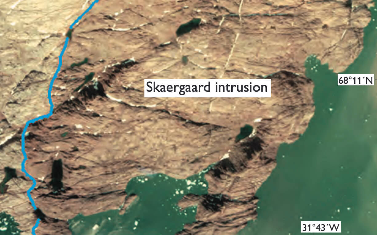
The powerful 3D mapping tool at the photogrammetry laboratory of the Geological Survey of Denmark and Greenland (GEUS) is ideal for collecting high-quality 3D geological data in remote and inaccessible areas with a high degree of exposure such as Greenland (Vosgerau et al. 2010). So far this 3D mapping tool has been used to visualise and extract very precise geological data from aerial and oblique photographs. In the study reported on here, the 3D mapping tool was used to generate data for 3D geological modelling. The Skaergaard intrusion (Fig. 1) is a well-known Eocene layered gabbro. The study of the intrusion has had great importance for the understanding of magmatic petrology, magma differentiation and fractional crystallisation since the early studies by Wager & Deer (1939). It was chosen for 3D modelling because it is well studied from a petrological point of view and because the shape of the magma chamber was previously modelled in a network of 2D cross sections (Nielsen 2004). In this paper, it is modelled for the first time in 3D using a detailed 1:20 000 scale geological map (McBirney 1989), 1:27 000 scale aerial photographs from 1973, data from drill holes and geophysical data.
How to Cite
Share
Copyright (c) 2012 Kristian Svennevig, Pierpaolo Guarnieri
This work is licensed under a Creative Commons Attribution 4.0 International License.
Downloads
Edited by Ole Bennike, Adam A. Garde and W. Stuart Watt
This Review of Survey activities presents a selection of 20 papers reflecting the wide spectrum of activities of the Geological Survey of Denmark and Greenland, from the microscopic to the plate-tectonic level.
The Survey's activities in Denmark and surrounding areas are illustrated by [...]