How to Cite


Share
Copyright (c) 2012 Søren Gregersen, Peter H Voss

This work is licensed under a Creative Commons Attribution 4.0 International License.
Abstract
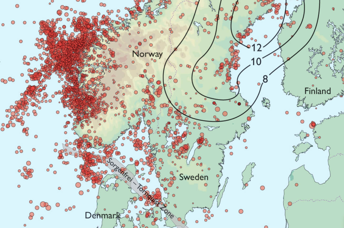
Assessment of earthquake hazard is improved if geological and geodetic data are included in addition to seismological data. In earthquake regions like Japan and California, palaeoseismology combines data from geology and seismology, and networks of permanent GPS (global positioning system) stations situated on bedrock supplement the networks of seismographs. A combination of seismographs and GPS stations on ice is also used in current studies of glacial earthquakes in Greenland. In Denmark only broad-scale geodetic coverage is available (Khan et al. 2005) and only a few examples of geological input are found in the literature. However, more thorough geodetic evaluations of deformations are currently made in Nordic co-operation projects and we are looking forward to learn about the results. Also the number of permanent GPS stations in Denmark has recently been increased from 3 to 13. The geological input is limited but may hold some potential, and the aim of this article is to evaluate this. We also discuss new investigations of recent geological movements, both in projects on post-glacial uplift (and accompanying horizontal deformation) of Scandinavia, and more locally of geological indicators of uplift in selected areas. As seismologists, we are interested in a homogeneous evaluation of geological indicators in all of Denmark and its neighbouring areas.
How to Cite
Share
Copyright (c) 2012 Søren Gregersen, Peter H Voss
This work is licensed under a Creative Commons Attribution 4.0 International License.
Downloads
Edited by Ole Bennike, Adam A. Garde and W. Stuart Watt
This Review of Survey activities presents a selection of 20 papers reflecting the wide spectrum of activities of the Geological Survey of Denmark and Greenland, from the microscopic to the plate-tectonic level.
The Survey's activities in Denmark and surrounding areas are illustrated by [...]