How to Cite


Share
Copyright (c) 2013 Knud Erik S Klint, Jon Engström, Andrew Parmenter, Timo Ruskeeniemi, Lillemor Claesson Liljedahl, Anne Lehtinen

This work is licensed under a Creative Commons Attribution 4.0 International License.
Abstract
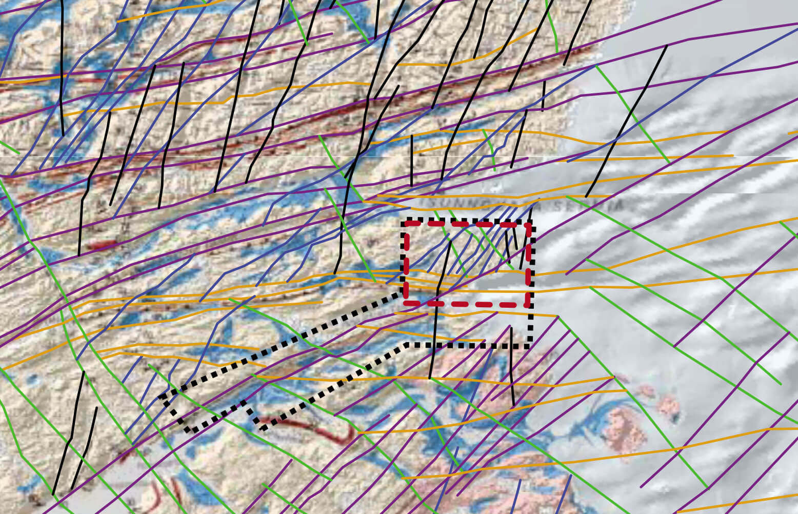
How could future ice ages affect deep nuclear waste repositories in crystalline basement rocks? Deep repositories may be affected by a number of glacially induced processes including, but not limited to, (1) fault activation or re-activation and associated seismicity, (2) changing hydraulic and chemical groundwater dynamics and (3) enhanced erosion. Such processes are likely to affect not only man-made barriers in spent fuel repositories such as copper canisters and bentonite clay buffers, but also the rock masses that contain and isolate the repositories. In order to increase our understanding of this problem, an international study (the Greenland Analogue Project) was set up in 2008. The aim of the study was to use crystalline bedrock at the margin of the Inland Ice near Kangerlussuaq airport in West Greenland as an analogue for future nuclear fuel waste repositories affected by glaciation in Fennoscandia and Canada. Accordingly, a wide range of field surveys were conducted for the analogue project (Fig. 1). This paper describes a detailed structural investigation of lineament zones and the establishment of an event succession for fault and fracture zone evolution in central parts of the study area (Figs 1B, 2), as well as an interpretation of the distribution of fracture and fault zones with potentially increased permeability. Three deep holes were drilled in the study area, and instruments were installed in two of them for subsequent down-hole sampling and monitoring of groundwater to a depth of c. 600 m. The cores were used to compare the subsurface fracture patterns with those established on the basis of surface mapping.
How to Cite
Share
Copyright (c) 2013 Knud Erik S Klint, Jon Engström, Andrew Parmenter, Timo Ruskeeniemi, Lillemor Claesson Liljedahl, Anne Lehtinen
This work is licensed under a Creative Commons Attribution 4.0 International License.
Downloads
Edited by Ole Bennike, Adam A. Garde and W. Stuart Watt
This Review of Survey activities presents a selection of 17 papers reflecting the wide spectrum of activities of the Geological Survey of Denmark and Greenland, from the microscopic to the plate-tectonic level.
The Survey's activities in Denmark and surrounding areas are [...]