How to Cite


Share
Copyright (c) 2013 Stig A Schack Pedersen, Peter Roll Jakobsen, Lisbeth Tougaard, Peter Gravesen

This work is licensed under a Creative Commons Attribution 4.0 International License.
Abstract
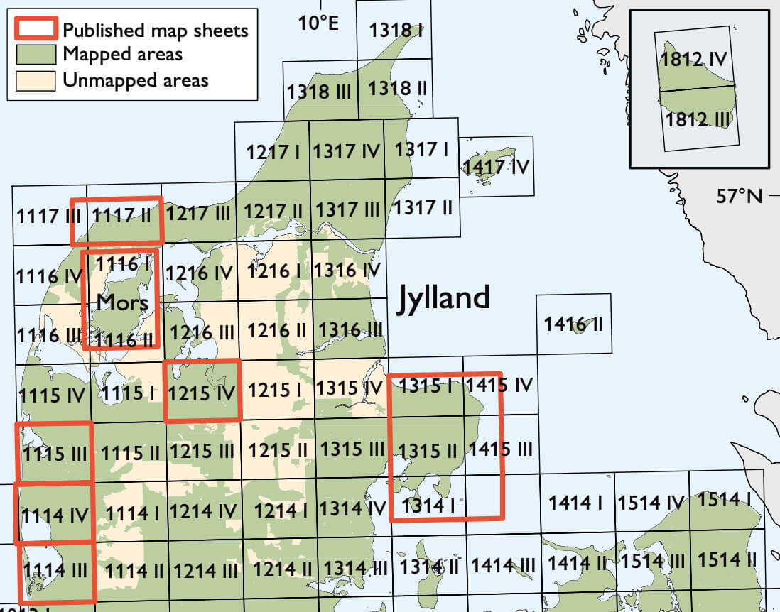
Danish geological maps of deposits occurring at the terrain surface are published under the name of Geological map of Denmark 1:50 000 and are based on geological field mapping at 1:25 000. Most of the published maps follow the map sheet division shown in Fig. 1. However, in some instances it is appropriate to publish geological maps covering a regional unit, such as an island. Hence, the geological map of Mors appears as the 1:50 000 map sheet Mors, which covers parts of map sheets 1116 I, 1116 II and 1116 III (Figs 1, 2; Pedersen & Jakobsen 2012). Mors shows spectacular examples of glaciotectonic structures that are beautifully exposed in coastal cliff sections. It also has a unique geological history, which is briefly described in this paper.
How to Cite
Share
Copyright (c) 2013 Stig A Schack Pedersen, Peter Roll Jakobsen, Lisbeth Tougaard, Peter Gravesen
This work is licensed under a Creative Commons Attribution 4.0 International License.
Downloads
Edited by Ole Bennike, Adam A. Garde and W. Stuart Watt
This Review of Survey activities presents a selection of 17 papers reflecting the wide spectrum of activities of the Geological Survey of Denmark and Greenland, from the microscopic to the plate-tectonic level.
The Survey's activities in Denmark and surrounding areas are [...]