How to Cite


Share
Copyright (c) 2013 Peter Roll Jakobsen, Urs Wegmuller, Ren Capes, Stig A Schack Pedersen

This work is licensed under a Creative Commons Attribution 4.0 International License.
Abstract
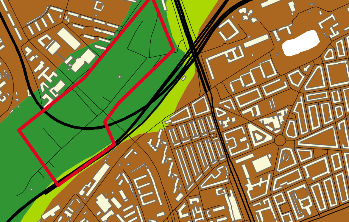
In the European Union (EU) project Terrafirma, which is supported by the European Space Agency to stimulate the Global Monitoring Environment System, we are using the latest technology to measure terrain motion on the basis of satellite radar data. The technique we employ is known as persistent scatterer interferometry (PSI); in Denmark, it was previously used to map areas of subsidence susceptible to flooding in the Danish part of the Wadden Sea (Vadehavet) area (Pedersen et al. 2011). That study was part of the flooding risk theme under the TerraFirma Extension project. Another coastal protection monitoring activity in the EU seventh framework project SubCoast followed, in which the low-lying south coast of Lolland, prone to flooding, was studied. The Geological Survey of Denmark and Greenland (GEUS) is also involved in the three-year EU collaborative project PanGeo in which GEUS is one of 27 EU national geological surveys. The objective of PanGeo is to provide free and open access to geohazard information in support of the Global Monitoring Environment System. This will be achieved by providing a free, online geohazard information service for the two largest cities in each EU country, i.e. 52 towns throughout Europe with c. 13% of EU’s population.
How to Cite
Share
Copyright (c) 2013 Peter Roll Jakobsen, Urs Wegmuller, Ren Capes, Stig A Schack Pedersen
This work is licensed under a Creative Commons Attribution 4.0 International License.
Downloads
Edited by Ole Bennike, Adam A. Garde and W. Stuart Watt
This Review of Survey activities presents a selection of 17 papers reflecting the wide spectrum of activities of the Geological Survey of Denmark and Greenland, from the microscopic to the plate-tectonic level.
The Survey's activities in Denmark and surrounding areas are [...]