How to Cite


Share
Copyright (c) 2013 Carina Bendixen, Jørn Bo Jensen, Ole Bennike, Lars Ole Boldreel

This work is licensed under a Creative Commons Attribution 4.0 International License.
Abstract
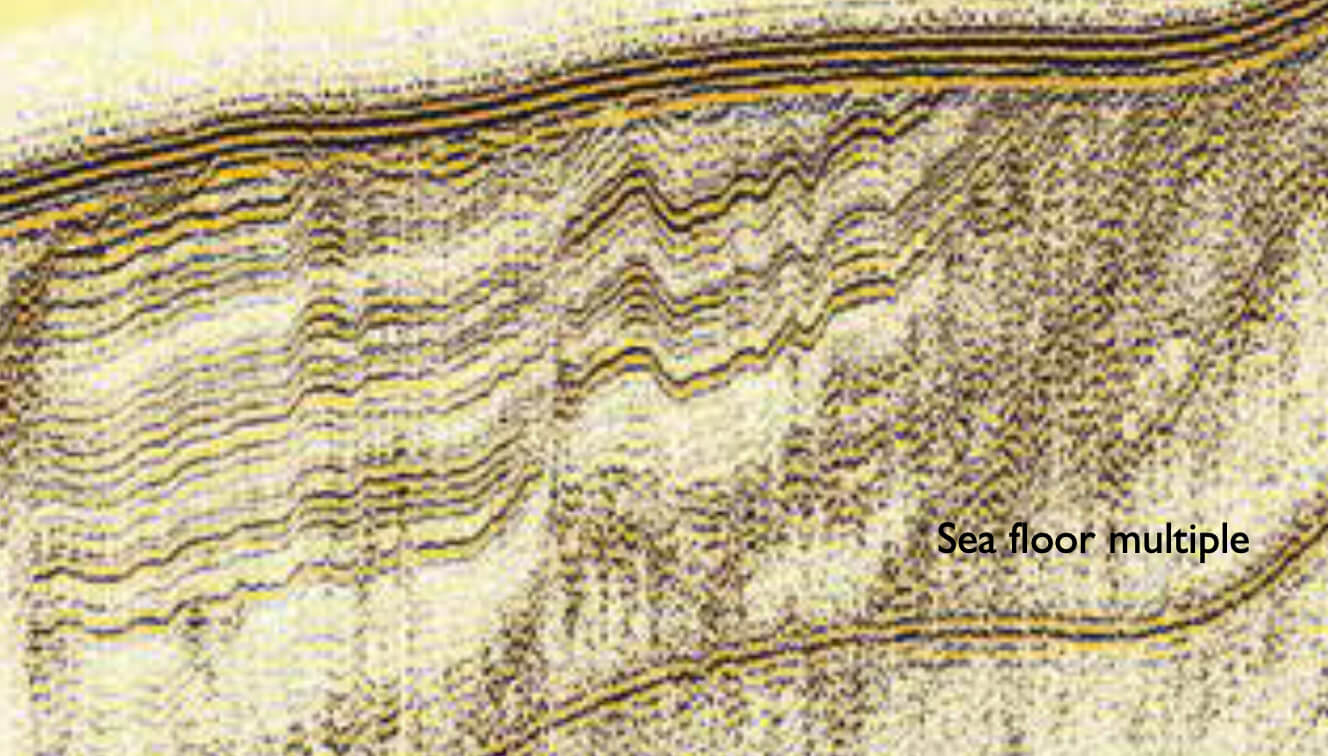
The Kattegat region is located in the wrench zone between the Fennoscandian shield and the Danish Basin that has repeatedly been tectonically active. The latest ice advances during the Quaternary in the southern part of Kattegat were from the north-east, east and south-east (Larsen et al. 2009). The last deglaciation took place at c. 18 to 17 ka BP (Lagerlund & Houmark-Nielsen 1993; Houmark-Nielsen et al. 2012) and was followed by inundation of the sea that formed a palaeo-Kattegat (Conradsen 1995) with a sea level that was relatively high because of glacio-isostatic depression. Around 17 ka BP, the ice margin retreated to the Øresund region and meltwater from the retreating ice drained into Kattegat. Over the next millennia, the region was characterised by regression because the isostatic rebound of the crust surpassed the ongoing eustatic sea-level rise, and a regional lowstand followed at the late glacial to Holocene transition (Mörner 1969; Thiede 1987; Lagerlund & Houmark-Nielsen 1993; Jensen et al. 2002a, b).
How to Cite
Share
Copyright (c) 2013 Carina Bendixen, Jørn Bo Jensen, Ole Bennike, Lars Ole Boldreel
This work is licensed under a Creative Commons Attribution 4.0 International License.
Downloads
Edited by Ole Bennike, Adam A. Garde and W. Stuart Watt
This Review of Survey activities presents a selection of 17 papers reflecting the wide spectrum of activities of the Geological Survey of Denmark and Greenland, from the microscopic to the plate-tectonic level.
The Survey's activities in Denmark and surrounding areas are [...]