How to Cite


Share

This work is licensed under a Creative Commons Attribution 4.0 International License.
Abstract
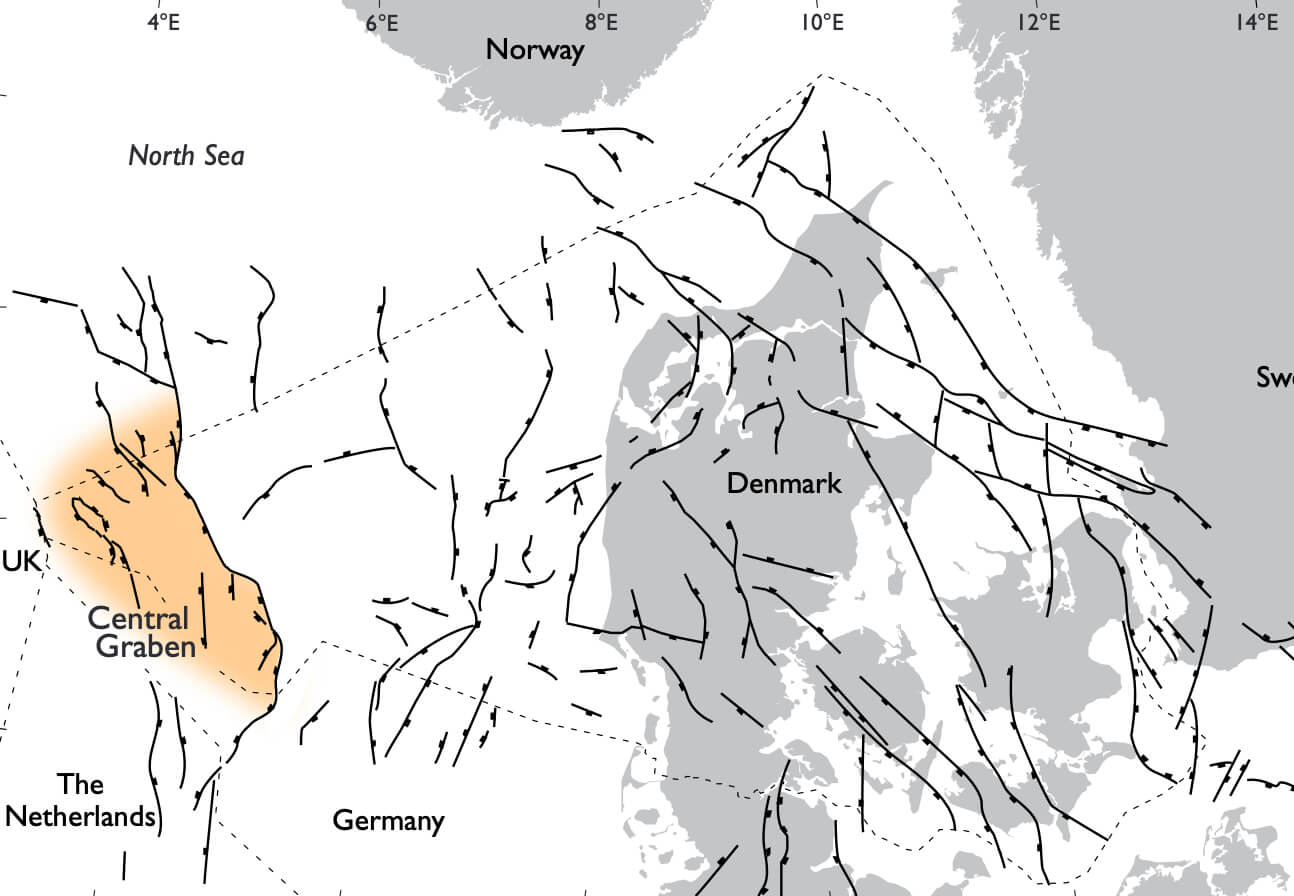
The Danish Central Graben is part of the mainly Late Jurassic complex of grabens in the central and southern North Sea which form the Central Graben. The tectonic elements of the Danish Central Graben in the Late Jurassic are outlined and compared to those in the Early Cretaceous based on reduced versions of published maps (1:200 000), compiled on the basis of all 1994 public domain seismic and well data. The Tail End Graben, a half-graben which stretches for about 90 km along the East North Sea High, is the dominant Late Jurassic structural feature. The Rosa Basin (new name) is a narrow, north–south-trending basin extending from the south-western part of the Tail End Graben. The Tail End Graben ceased to exist as a coherent structural element during the Early Cretaceous and developed into three separate depocentres: the Iris and Gulnare Basins to the north and the Roar Basin to the south (new names). The Early Cretaceous saw a shift from subsidence focused along the East North Sea High during the Late Jurassic to a more even distribution of minor basins within the Danish Central Graben. The depth to the top of the Upper Jurassic – lowermost Cretaceous Farsund Formation reaches a maximum of 4800 m in the northern part of the study area, while the depth to the base of the Upper Jurassic reaches 7500 m in the Tail End Graben, where the Upper Jurassic attains a maximum thickness of 3600 m. The Lower Cretaceous Cromer Knoll Group attains a maximum thickness of 1100 m in the Outer Rough Basin.
How to Cite
Share
Downloads
Editors: Jon R. Ineson and Finn Surlyk
The Jurassic rocks of Denmark and East Greenland record the evolution of two discrete portions of the Mesozoic rift complex, now separated by the North Atlantic Ocean. The Jurassic of Denmark and adjacent areas occurs mostly in the subsurface and research has thus focussed [...]