How to Cite


Share
Copyright (c) 2015 Robert S Fausto, Dirk van As, Jens A Antoft, Jason E Box, William Colgan

This work is licensed under a Creative Commons Attribution 4.0 International License.
Abstract
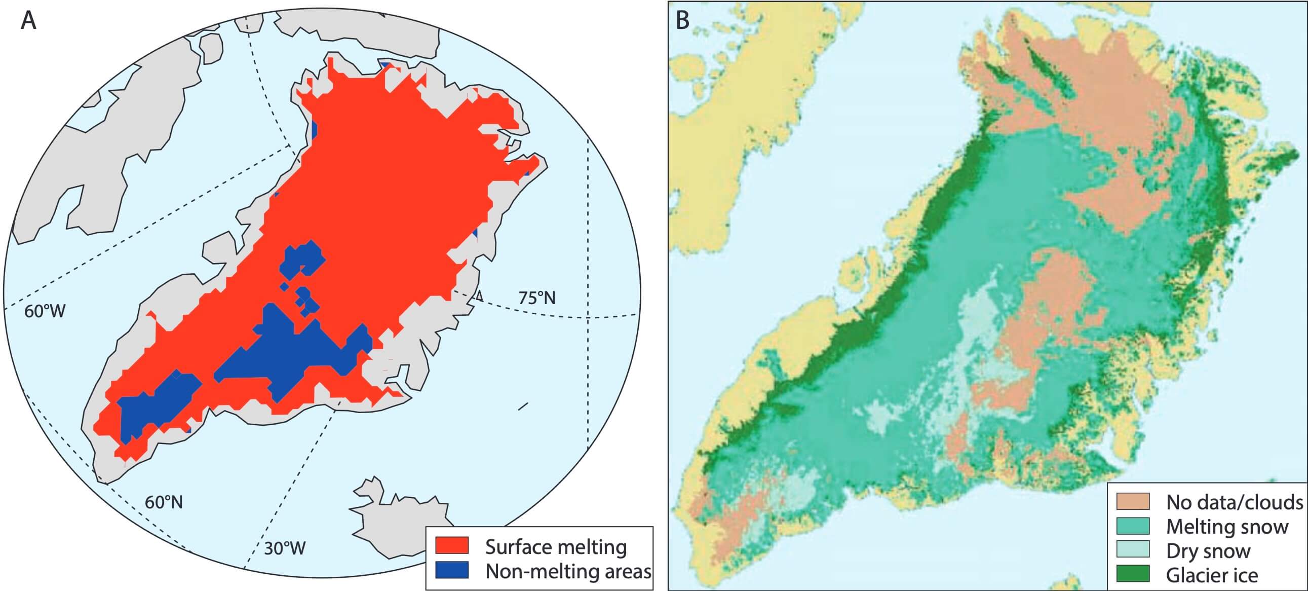
The Greenland ice sheet is an excellent observatory for global climate change. Meltwater from the 1.8 million km2 large ice sheet influences oceanic temperature and salinity, nutrient fluxes and global sea level (IPCC 2013). Surface reflectivity is a key driver of surface melt rates (Box et al. 2012). Mapping of different ice-sheet surface types provides a clear indicator of where changes in ice-sheet surface reflectivity are most prominent. Here, we present an updated version of a surface classification algorithm that utilises NASA’s Moderate resolution Imaging Spectroradiometer (MODIS) sensor on the Terra satellite to systematically monitor ice-sheet surface melt (Fausto et al. 2007). Our aim is to determine the areal extent of three surface types over the 2000–2014 period: glacier ice, melting snow (including percolation areas) and dry snow (Cuffey & Paterson 2010). Monthly 1 km2 resolution surface-type grids can be downloaded via the CryoClim internet portal (www.cryoclim.net). In this report, we briefly describe the updated classification algorithm, validation of surface types and inter-annual variability in surface types.
How to Cite
Share
Copyright (c) 2015 Robert S Fausto, Dirk van As, Jens A Antoft, Jason E Box, William Colgan
This work is licensed under a Creative Commons Attribution 4.0 International License.
Downloads
Editors Ole Bennike, Adam A. Garde and W. Stuart Watt
This Review of Survey activities presents a selection of 20 papers reflecting the wide spectrum of activities of the Geological Survey of Denmark and Greenland, from the microscopic to the plate-tectonic level.
The Survey’s activities in Denmark are illustrated by eight articles [...]