How to Cite


Share

This work is licensed under a Creative Commons Attribution 4.0 International License.
Abstract
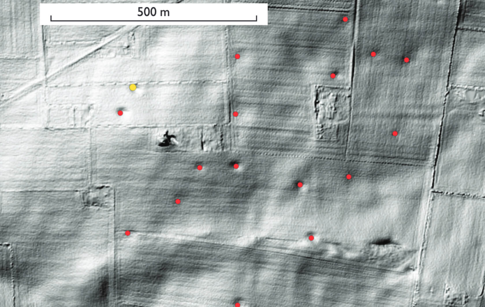
Danish glacial landscape elements such as basal till plains, hummocky moraine areas and outwash plains contain a variety of small and large depressions. They were probably formed in glacial, late-glacial or Holocene time and may represent dead-ice holes or degraded pingos, or sinkholes formed by interaction between pre-Quaternary chalk or limestone bedrock and the thin glacial co ver. The aim of this study is to map terrain depressions that might potentially be karst sinkholes by analysing digital terrain models in the geographic information system (GIS). The incentive to apply the technique for mapping of sinkholes came from an accidental acquaintance with a farmer, Jens Kirk, whose farmland is located near Thisted. Jens Kirk told us that the front end of his tractor had suddenly sunk into the ground during routine farming work, and this incident was our inspiration to start the project described here.
How to Cite
Share
Downloads
Editors Adam A. Garde and Ole Bennike
The 17 contributions in this Review of Survey activities reflect the wide range of activities currently performed by the Geological Survey of Denmark and Greenland, commonly in collaboration with external partners.
Topics in and around Denmark include the important Danish potential for geothermal energy, a shale gas [...]