How to Cite


Share

This work is licensed under a Creative Commons Attribution 4.0 International License.
Abstract
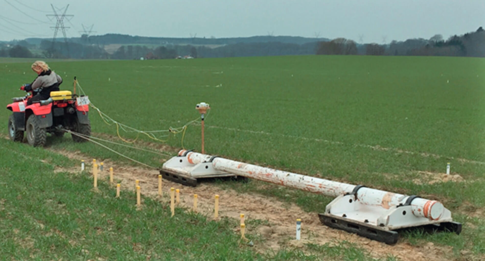
There is a growing demand in modern society for detailed, localised geological maps and 3D models in connection with e.g. planning of major construction works, study of subsurface drainage systems, infiltration of storm water or risk assessment of contaminated waste dumps and pollution plumes. This demand is difficult to meet in Denmark as the surficial glacial deposits that cover most of the country are notoriously very heterogeneous. Standard geological maps are based on regional data collection, and their resolution is far from sufficient to identify structural elements on the 10–20 m scale needed in the above-mentioned applications. Geophysical mapping for geological characterisation of the upper c. 5 m of the subsurface can be carried out using for instance direct-current geoelectrical methods (e.g. Loke et al. 2013), induced polarisation (e.g. Revil et al. 2012) set up with 1–2 m electrode spacing, electromagnetic induction (EMI; e.g. Christiansen et al. 2016; Doolittle & Brevik 2014), ground penetrating radar (GPR; e.g. Neal 2004) or seismic refraction tomography using a multicomponent landstreamer (e.g. Brodic et al. 2015). The resulting geophysical maps show the distribution of the measured parameter, for instance electric resistivity or seismic velocity. To construct geological maps using geophysical methods, the data must be verified and calibrated with geological field observations. GPR imaging of geological structures require laborious interpretation before a geological map can be constructed, and the method is limited to low-loss materials such as sandy sediments (Neal 2004). A new approach, using a combination of shallow, highresolution EMI surveying and traditional spear-auger soil sampling along the same transects, was tested in an area of c. 2 km2 around the contaminated, former landfill site at Pillemark on Samsø (Fig. 1). The resistivity recorded using the EMI method is strongly related to the clay content, and this parameter is therefore well suited for geological mapping. The EMI method is also robust, data acquisition is 5–50 times faster than with other geophysical methods and the processing and inversion scheme is well defined (Christiansen et al. 2016).
How to Cite
Share
Downloads
Editors Adam A. Garde and Ole Bennike
The 17 contributions in this Review of Survey activities reflect the wide range of activities currently performed by the Geological Survey of Denmark and Greenland, commonly in collaboration with external partners.
Topics in and around Denmark include the important Danish potential for geothermal energy, a shale gas [...]