How to Cite


Share

This work is licensed under a Creative Commons Attribution 4.0 International License.
Abstract
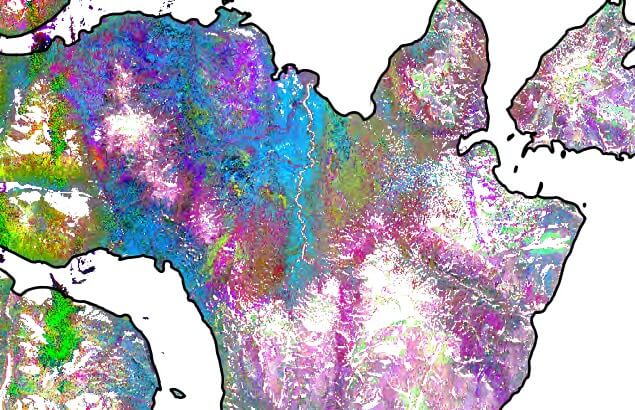
Spaceborne remote sensing is a suitable tool for early mineral exploration and surveying large areas of high Arctic environment in a fast and cost-effective manner. While spaceborne data have been used widely to map geology in arid areas, similar approaches for remotely-sensed geological mapping of Arctic environments is yet to be developed. Freely available spaceborne optical data provides detailed information of high-quality that could potentially reduce resource exploration risk in remote regions. To this end, this study compares the use of two different multispectral spaceborne datasets (i.e. the Advanced Spaceborne Thermal Emission and Reflection Radiometer (ASTER) and Sentinel-2) to map geological units in and around Wollaston Forland, North-East Greenland – an area rich in Jurassic and Cretaceous sedimentary rocks and important targets for offshore petroleum exploration. Multispectral image sensors simultaneously capture image data within multiple wavelength ranges (bands) across the electromagnetic spectrum. Each band is commonly described by the band number and the band wavelength centre position. Here, we identify the bands most suitable for geological mapping in an Arctic setting, using the Wollaston Forland area as an example. We compare the results obtained by processing spaceborne data with a published geological map for the area (Henriksen 2003).
How to Cite
Share
Downloads